Werdau
| Werdau | ||
|---|---|---|
.jpg) The town hall in Werdau | ||
| ||
 Werdau Location of Werdau within Zwickau district 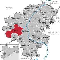 | ||
| Coordinates: 50°44′N 12°23′E / 50.733°N 12.383°ECoordinates: 50°44′N 12°23′E / 50.733°N 12.383°E | ||
| Country | Germany | |
| State | Saxony | |
| District | Zwickau | |
| Government | ||
| • Mayor | Stefan Czarnecki (CDU) | |
| Area | ||
| • Total | 65.60 km2 (25.33 sq mi) | |
| Elevation | 334 m (1,096 ft) | |
| Population (2017-12-31)[1] | ||
| • Total | 20,795 | |
| • Density | 320/km2 (820/sq mi) | |
| Time zone | CET/CEST (UTC+1/+2) | |
| Postal codes | 08412 | |
| Dialling codes | 03761 | |
| Vehicle registration | Z, GC, HOT, WDA | |
| Website | www.werdau.de | |

Werdau is a town in Germany, part of the Landkreis Zwickau in the Free State of Saxony. It is situated on the river Pleiße, 8 km from Zwickau.
In 1905, the city held a contest for the design of a new town hall (see right), as the old one built in 1727 had become too small. The tower and floorplan of one design was combined with the façade of another, and ground was broken for construction on August 1, 1908. It was inaugurated on April 26, 1911, with Frederick Augustus III of Saxony in attendance.[2][3]
Werdau station is located on the Leipzig–Hof railway.
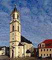 Marien-Church
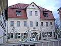 City Museum
.jpg) Cemetery chapel
Cemetery chapel.jpg) Advertising clock
Advertising clock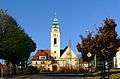 Catholic Church
References
- ↑ "Aktuelle Einwohnerzahlen nach Gemeinden 2017] (Einwohnerzahlen auf Grundlage des Zensus 2011)" (PDF). Statistisches Landesamt des Freistaates Sachsen (in German). October 2018.
- ↑ Griesbacher, Thomas. "Werdau". Retrieved 2009-01-11.
- ↑ "Town Hall" (in German). Werdau.de. 2008. Retrieved 2009-01-11.
See also

This article is issued from
Wikipedia.
The text is licensed under Creative Commons - Attribution - Sharealike.
Additional terms may apply for the media files.