Remse
| Remse | |
|---|---|
 Remse Location of Remse within Zwickau district 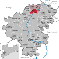  | |
| Coordinates: 50°51′14″N 12°34′32″E / 50.85389°N 12.57556°ECoordinates: 50°51′14″N 12°34′32″E / 50.85389°N 12.57556°E | |
| Country | Germany |
| State | Saxony |
| District | Zwickau |
| Municipal assoc. | Waldenburg |
| Government | |
| • Mayor | Wolf-Dieter Kapferer |
| Area | |
| • Total | 14.79 km2 (5.71 sq mi) |
| Elevation | 225 m (738 ft) |
| Population (2017-12-31)[1] | |
| • Total | 1,652 |
| • Density | 110/km2 (290/sq mi) |
| Time zone | CET/CEST (UTC+1/+2) |
| Postal codes | 08373 |
| Dialling codes | 03763 |
| Vehicle registration | Z |
| Website | www.remse-mulde.de |
Remse is a municipality in the district of Zwickau in Saxony in Germany. Remse is loceted 2 miles north of Glauchau. Two federal highway cross the municipality. Besides that the federal Autobahn A4 is accessible from south of town.
Neighborhood Communities
Neighborhood municipalities are Oberwiera and Schönberg as well as Meerane, Glauchau and Waldenburg.
References
- ↑ "Aktuelle Einwohnerzahlen nach Gemeinden 2017] (Einwohnerzahlen auf Grundlage des Zensus 2011)" (PDF). Statistisches Landesamt des Freistaates Sachsen (in German). October 2018.
This article is issued from
Wikipedia.
The text is licensed under Creative Commons - Attribution - Sharealike.
Additional terms may apply for the media files.