Webster, Kansas
| Webster, Kansas | |
|---|---|
| Unincorporated community | |
| Coordinates: 39°23′13″N 99°25′04″W / 39.38694°N 99.41778°WCoordinates: 39°23′13″N 99°25′04″W / 39.38694°N 99.41778°W | |
| Country | United States |
| State | Kansas |
| County | Rooks |
| Township | Belmont |
| Founded | 1885 |
| Elevation | 1,937 ft (590 m) |
| Time zone | UTC-6 (Central (CST)) |
| • Summer (DST) | UTC-5 (CDT) |
| ZIP code | 67669 |
| Area code(s) | 785 |
| GNIS feature ID | 484592[1] |

Webster was an unincorporated community in Belmont Township, Rooks County, Kansas, United States.[2]
History
The community of Webster was established in the Solomon Valley along the South Fork Solomon River in the late 1870s. Webster was created from two settlements; Webster settled on the north side of the river and Belmont that originated on the south side of the river.
Belmont was founded as a trading post in 1876. Due to flooding, the Belmont settlement was moved across the river adjoining the Webster settlement. Belmont was first to file an application for a post office. The Belmont application was denied as another Kansas town had previously been granted the name. Instead, Webster was granted a post office in 1879.[3]
Webster, named for Daniel Webster, was surveyed, platted and filed in 1885. The town was never incorporated.[4]
In 1888, Webster had two doctors, two churches, a school and 24 businesses. A large city park called The Grove featured towering cottonwood trees. The population in 1910 was 200.[5]
Construction of Webster Dam on the South Fork Solomon River was approved in 1953. Webster Reservoir would encompass the area occupied by the town of Webster. As a result, the town was relocated 2 miles to the southeast. Many businesses and residents chose not to relocate to the new town site.[6]
Geography
Webster is located at 39°23′13″N 99°25′04″W / 39.38694°N 99.41778°W (39.386944, -99.417778) at an elevation of 1,937 feet (590 m). It lies approximately 0.5 miles (0.80 km) south-southeast of Webster Dam in the Smoky Hills region of the Great Plains.[7][8] Webster is 0.3 miles (0.48 km) east of Kansas Highway 258, 2.5 miles (4.0 km) south of U.S. Route 24, and roughly 8 miles (13 km) west-southwest of Stockton, the county seat.[7]
The original site of Webster was located at 39°24′06″N 99°26′09″W / 39.40167°N 99.43583°W (39.4016756, -99.4359370), a location now submerged beneath Webster Reservoir. The site had an elevation of 1,893 feet (577 m).[1]
Education
Webster High School was closed in 1963. The grade school closed in 1969.[6] The Webster High School mascot was Webster Eagles.
Transportation
Webster lies at the intersection of two unpaved county roads: 11 Road, which runs north-south, and M Terrace, which runs east-west.[7]
References
- 1 2 "Webster". Geographic Names Information System. United States Geological Survey. Retrieved 2015-11-19.
- ↑ "General Highway Map - Rooks County, Kansas" (PDF). Kansas Department of Transportation. 1980. Retrieved 2015-11-19.
- ↑ "Kansas Post Offices, 1828-1961". Kansas Historical Society. Retrieved 20 December 2016.
- ↑ "Origin of Town Names" (PDF). Solomon Valley Highway 24 Heritage Alliance. p. 5. Retrieved 9 April 2018.
- ↑ Blackmar, Frank Wilson (1912). Kansas: A Cyclopedia of State History, Volume 2, Chicago: Standard Publishing Company, p. 898
- 1 2 "History of Webster" (PDF). Solomon Valley Highway 24 Heritage Foundation. Retrieved 30 December 2016.
- 1 2 3 "General Highway Map - Rooks County, Kansas". Kansas Department of Transportation. January 2010. Retrieved 2015-11-19.
- ↑ "2003-2004 Official Transportation Map" (PDF). Kansas Department of Transportation. 2003. Retrieved 2015-11-19.
External links
- Rooks County
- Historic Images, Wichita State University Library
- Rooks County Maps: Current, Historic, KDOT
Municipalities and communities of Rooks County, Kansas, United States | ||
|---|---|---|
| Cities | 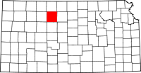 | |
| Unincorporated community | ||
| Ghost towns | ||
| Townships | ||