Wayana
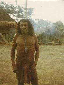 Wayana man, 1979 | |
| Total population | |
|---|---|
| 1,500[1] (2006) | |
| Regions with significant populations | |
|
French Guiana Suriname Brazil | |
| Languages | |
| Wayana | |
| Related ethnic groups | |
| Aparai |
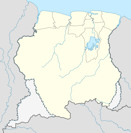
The Wayana (alternate names: Ajana, Uaiana, Alucuyana, Guaque, Ojana, Orcocoyana, Pirixi, Urukuena, Waiano etc.) are a Carib-speaking people located in the south-eastern part of the Guiana highlands, a region divided between Brazil, Surinam, and French Guiana. In 1980, when the last census took place, the Wayana numbered some 1,500 individuals, of which 150 in Brazil, among the Apalai, 400 in Surinam, and 1,000 in French Guiana, along the Maroni River. About half of them still speak their original language.
History
According to both oral tradition and descriptions by 20th century European explorers, the Wayana emerged fairly recently as a distinctive group; contemporary Wayana are considered an amalgation of smaller ethnic groups such as the Upului, Opagwana, and Kukuyana.[2] In the eighteenth century, the ancestors of the Wayana lived along the Paru and Jari rivers in contemporary Brazil, and along the upper tributaries of the Oyapock river, which nowadays forms the border between French Guiana and Brazil.[3]
By the late 18th century, the ancestors of the Wayana were involved in an almost continuous military struggle with Tupi peoples such as the Wayampi, which drove them across the Tumuk Humak Mountains to the upper tributaries of the Litani river.[4] Around the same time, the Aluku maroons, who had fled plantations in Suriname, were driven up the Litani river by Dutch colonial forces aided by Ndyuka maroons, who had settled for peace with the colonial authorities in return for military assistance against "incursions" from new maroon groups. From that moment on, an intensive trade relationship developed between the Wayana and the Aluku.[5]
Over time, the Wayana migrated with the Aluku further downstream the Litani and Lawa rivers to end up in their contemporary position. In 1865, the Ndyuka granman Alabi invited a Wayana group still living along the Paru river in Brazil to join them along the Tapanahony river in Suriname, probably inspired by the arrangement with the Wayana that the Aluku had. This particular group still lives in villages along the Tapanahony and Palumeu rivers.[5]
Society and culture
Wayana society is characterized by a rather low degree of social stratification. Villages often comprise not more than one extended family and are rather loosely linked to their neighbouring villages by kinship ties, marital exchanges, shared rituals and trade. Missionaries and representatives of the state have only partially succeeded to group the Wayana together in larger settlements, and despite the fact that the Wayana are not as nomadic as before, villages are by no means permanent, and are often abandoned after the death of a leader.[6]
Villages are often led by a shaman or pïyai, who mediate Wayana contact with the world of spirits and deities, act as healers, and who are consulted in matters concerning hunting and fishing. Many Wayana villages still feature a community house or tukusipan.
Ëputop
Coming of age was for a long time associated with a ritual called ëputop or maraké, in which a wicker frame full of stinging ants or wasps was applied to the bodies of adolescent boys and girls, who emerged from the ceremony as adult men and women. While older Wayana still to a degree define their Wayanahood by the number of ëputop they underwent during their lifetime, many younger Wayana reject the necessity of undergoing ëputop to become a valued member of society. As a result, few ëputop ceremonies occur today.[7] One of the more recent ëputop ceremonies took place in 2004 in the village of Talhuwen, organized by Aïmawale Opoya, grandson of Wayana leader Janomalë, in consultation with French film director Jean-Philippe Isel, who made a documentary about the ritual.[8][9][10]
In spite of its demise, ëputop was listed on the inventory of intangible cultural heritage drawn up by the French Ministry of Culture in 2011.
Political organisation
Before contact with missionaries and state representatives, the Wayana did not recognise a form of leadership that transcended the village level. The Surinamese, French, and Brazilian states preferred centralise their dealings with the Wayana, however, and for this purpose installed captains, head captains and granman among the Wayana leaders. As the concept of a paramount chief goes against Wayana ideas of political organisation, the authority of these chiefs beyond their own villages is often limited.[11][12]
In Suriname, Kananoe Apetina was made "head captain" of the Wayana on the Tapanahony river in 1937, while Janomalë was made "head captain" of the Wayana on the Lawa and Litani rivers in 1938. After the death of Janomalë in 1958, Anapaikë was installed as his successor, and served as the leader of the Wayana on the Surinamese side of the Lawa river until he passed away in 2003.[13] Kananu Apetina died in 1975 and was succeeded by Aptuk Noewahe, who is currently recognised by the Surinamese government as the granman of all Wayana in Suriname. The current head captain on the Lawa river is Ipomadi Pelenapïn, who was installed in August 2005.[12]
The current granman of the Wayana in French Guiana is Amaipotï, son of first granman Twenkë, who resides in the village of Kulumuli.
Contemporary settlements
Notes
- ↑ Heemskerk et al. 2007, p. 74.
- ↑ Boven 2006, p. 59.
- ↑ Boven 2006, p. 63.
- ↑ Boven 2006, pp. 63, 67.
- 1 2 Boven 2006, p. 77.
- ↑ "Wayana: social organisation". Povos Indígenas no Brazil. Retrieved 1 March 2018.
- ↑ Boven 2006, pp. 147-156.
- ↑ Boven 2006, p. 154.
- ↑ "« Ëputop, un maraké wayana » Un film de Jean-Philippe Isel". Blada.com. Retrieved 22 March 2018.
- ↑ "Eputop, un maraké wayana". Télérama.fr. Retrieved 22 March 2018.
- ↑ "Wayana: political organisation". Povos Indígenas no Brazil. Retrieved 1 March 2018.
- 1 2 Boven, p. 243.
- ↑ Boven, p. 168.
- 1 2 Heemskerk et al. 2007, p. 38.
- 1 2 3 4 5 Duin 2009, p. 138.
- 1 2 3 4 5 Heemskerk et al. 2007, p. 21.
- 1 2 3 Duin 2009, p. 394.
- ↑ Duin 2009, p. 239.
- 1 2 3 Duin 2009, p. 139.
- 1 2 3 4 5 6 7 8 9 10 11 12 13 14 15 16 17 "Caracterização do DSEI Amapá e Norte do Pará, conforme Edital de Chamada Pública n. 2/2017 (item 3.1)" (PDF). portalarquivos.saude.gov.br. 30 June 2016. Retrieved 17 May 2018.
References
| Wikimedia Commons has media related to Wayana. |
- Alì, Maurizio & Ailincai, Rodica. (2013). “Learning and Growing in indigenous Amazonia. The Education System of French Guyana Wayana-Apalai communities”. Procedia - Social and Behavioral Sciences (Elsevier), 106 (10): 1742-1752. ISSN 1877-0428. doi:10.1016/j.sbspro.2013.12.196
- Boven, Karin M. (2006). Overleven in een Grensgebied: Veranderingsprocessen bij de Wayana in Suriname en Frans-Guyana (PDF). Amsterdam: Rozenberg Publishers.
- Duin, Renzo Sebastiaan (2009). Wayana Socio-political Landscapes: Multi-scalar Regionality and Temporality in Guiana (PDF). University of Florida.
- Fleury, Marie; Opoya, Tasikale; Aloïké, Waiso (2016). "Les Wayana de Guyane française sur les traces de leur histoire". Revue d’ethnoécologie [En ligne]. 9. doi:10.4000/ethnoecologie.2711.
- Heemskerk, Marieke; Delvoye, Katia; Noordam, Dirk; Teunissen, Pieter (2007). Wayana Baseline Study: A sustainable livelihoods perspective on the Wayana Indigenous Peoples living in and around Puleowime (Apetina), Palumeu, and Kawemhakan (Anapaike) in Southeast Suriname (PDF). Paramaribo: Stichting Amazon Conservation Team-Suriname.
- Ricardo, Carlos Alberto, ed. (1983). Povos indígenas no Brasil vol. 3: Amapá / Norte do Pará (PDF). São Paulo: CEDI.
- Van Velthem, Lucia Hussak (1976). "Representações gráficas Wayãna-Aparaí" (PDF). Boletim do Museo Paraense Emílio Goeldi. 64: 1–19. Retrieved 6 March 2018.
- Van Velthem, Lucia Hussak (1980). "O Parque Indígena de Tumucumaque" (PDF). Boletim do Museo Paraense Emílio Goeldi. 76: 1–31. Retrieved 6 March 2018.
- Van Velthem, Lucia Hussak (1990). "Os Wayana, as águas, os peixes e a pesca" (PDF). Boletim do Museo Paraense Emílio Goeldi. Série Antropologia. 6 (1): 107–116. Retrieved 6 March 2018.
- Van Velthem, Lucia Hussak (2009). "Mulheres de cera, argila e arumã: princípios criativos e fabricação material entre os Wayana". Mana. 15 (1): 213–236. doi:10.1590/S0104-93132009000100008.
- Van Velthem, Lucia Hussak (2010a). "Artes indígenas: notas sobre a lógica dos corpos e dos artefatos". Textos escolhidos de cultura e arte populares. 7 (1): 19–29. doi:10.12957/tecap.2010.12052.
- Van Velthem, Lucia Hussak (2010b). "Os "originais" e os "importados": referências sobre a apreensão wayana dos bens materiais". Indiana. 27: 141–159. doi:10.18441/ind.v27i0.141-159.
- Van Velthem, Lucia Hussak (2014). "Serpentes de Arumã. Fabricação e estética entre os Wayana (Wajana) na Amazônia Oriental". PROA: Revista de antropologia e arte. 5 (1). Retrieved 6 March 2018.
- Van Velthem, Lucia Hussak; Van Velthem Linke, Iori Leonel H. (2010). Livro da Arte Gráfica Wayana e Aparai: Waiana anon imelikut pampila – Aparai zonony imenuru papeh (PDF). Rio de Janeiro: Museu do Índio – FUNAI / IEPÉ. ISBN 978-85-85986-29-2.
- "Wayana". Ethnologue.com.
- Wilbert, Johannes; Levinson, David (1994). Encyclopedia of World Cultures. Volume 7: South America. Boston: G. K. Hall. ISBN 0-8161-1813-2
Further reading
- Devillers, Carole (January 1983). "What Future for the Wayanas?". National Geographic. Vol. 163 no. 1. pp. 66–83. ISSN 0027-9358. OCLC 643483454.
| Indigenous | |
|---|---|
| Non-Indigenous | |
| |||||||||||||||||||
| |||||||||||||||||||
| |||||||||||||||||||
| |||||||||||||||||||