Washington Heights, Chicago
| Washington Heights | |
|---|---|
| Community area | |
| Community Area 73 - Washington Heights | |
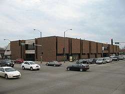 Carter G. Woodson Regional Library | |
 Location within the city of Chicago | |
| Coordinates: 41°43.2′N 87°39.0′W / 41.7200°N 87.6500°WCoordinates: 41°43.2′N 87°39.0′W / 41.7200°N 87.6500°W | |
| Country | United States |
| State | Illinois |
| County | Cook |
| City | Chicago |
| Neighborhoods |
list
|
| Area | |
| • Total | 2.87 sq mi (7.43 km2) |
| Population (2015) | |
| • Total | 27,116[1] |
| Demographics (2015)[1] | |
| • White | 1.29% |
| • Black | 95.77% |
| • Hispanic | 1.06% |
| • Asian | 0% |
| • Other | 1.88% |
| Time zone | UTC-6 (CST) |
| • Summer (DST) | UTC-5 (CDT) |
| ZIP Codes | parts of 60620, 60628 and 60643 |
| Median income[1] | $44,071 |
| Source: U.S. Census, Record Information Services | |
Washington Heights, one of the 77 official community areas, is located on the far south side of the city of Chicago, Illinois.
History
Illinois Place Names (Illinois State Historical Society Occasional Publications Number 55, 1989) indicates that the area of Washington Heights historically was also known as Blue Island Ridge, Campbell's Woods, Dummy Junction, and North Blue Island.
Washington Heights was established as a suburb in 1869. The building of the suburb was facilitated by the Blue Island Land and Building Company led by Frederick Hampden Winston, George D. Walker and President of the Rock Island Railroad John F. Tracy.[2] A Post Office by the name of Washington Heights was established 25 October 1869 and dissolved 6 June 1894. As noted, it is now part of Chicago. It was one of the many small towns and villages that were annexed into the City of Chicago in the late 19th century. At this time, it was predominantly a bedroom community of German and Irish families whose immigration to the Midwestern United States began circa 1880.
White flight
The landscape of Washington Heights changed beginning in the late 1960s as a result of two factors. The West Leg extension of the Dan Ryan Expressway, more commonly known as Interstate 57, cut through the southern half of the community, dividing the area and displacing several long-time residents. It opened in October 1967. Simultaneously, a growing number of African Americans began moving into the community. Adjacent Auburn Gresham and Roseland also began experiencing white flight during the 1960s in the same way that communities to the north, such as Englewood and Greater Grand Crossing, experienced the decade prior. In the 1970s the demographics of Washington Heights changed primarily to African-American, as it still exists today. The community continues to retain its middle-class character.
Twenty first century
Washington Heights has seen redevelopment in recent years. One of the largest single-family home developments in the city, "The Renaissance at Beverly Ridge," is under construction in the southwest corner of Washington Heights at W 105th Street and S Throop Ave on the former Chicago Bridge & Iron Company site.
Geography
The northern border of Washington Heights is the railroad tracks at 89th street and its southern border is West 107th Street. At various points its eastern border is Eggleston and Halstead and its western border is Beverly Avenue until 103rd Street. The western border then shifts to Vincennes Avenue.[3]
Land use in the community consists of 795.7 acres of single family residential housing, 69 acres of multifamily residential housing, 55.6 acres of commercial development, 36.6 acres of industrial development, 84.5 acres of institutional and 9.9 acres of mixed use development. There are 676.1 acres that can be defined as transportation and other.[1] A formerly abandoned railroad line that ran along the southwestern edge of the community was acquired by the Chicago Park District and converted into the "Major Taylor Trail" in 2007. It runs between the Dan Ryan Woods in Beverly and the Whistler Woods in suburban Riverdale, crossing the Calumet River and Interstate 57.
Demographics
| Historical population | |||
|---|---|---|---|
| Census | Pop. | %± | |
| 1930 | 17,865 | — | |
| 1940 | 19,370 | 8.4% | |
| 1950 | 24,488 | 26.4% | |
| 1960 | 29,793 | 21.7% | |
| 1970 | 36,540 | 22.6% | |
| 1980 | 36,453 | −0.2% | |
| 1990 | 32,114 | −11.9% | |
| 2000 | 29,843 | −7.1% | |
| 2010 | 26,493 | −11.2% | |
| Est. 2015 | 27,116 | 2.4% | |
| [1][4] | |||
According to a 2017 analysis by the Chicago Metropolitan Agency for Planning, there were 27,116 people and 9,501 households in Washington Heights. The racial makeup of the area was 1.3% White, 95.8% African American, and 1.9% from other races. Hispanic or Latino of any race were 1.1% of the population. In the area, the population was spread out with 22.5% under the age of 19, 17.9% from 20 to 34, 17.8% from 35 to 49, 21.9% from 50 to 64, and 19.8% who were 65 years of age or older. The median age was 42 years.[1]
The median household income was $44,071 compared to a median income of $47,831 for Chicago at-large. The area had an income distribution in which 27.3% of households earned less than $25,000 annually; 28.5% of households earned between $25,000 and $49,999; 16.8% of households earned between $50,000 and $74,999; 13.6% of households earned between $75,000 and $99,999; 11% of households earned between $100,000 and $149,999 and 2.8% of households earned more than $150,000. This is compared to a distribution of 28.8%, 22.8%, 16.1%, 10.7%, 11.3% and 10.3% for Chicago at large.[1]
Politics
Washington Heights is a stronghold of the Democratic Party. In the 2016 presidential election, Washington Heights cast 13,709 votes for Hillary Clinton and 229 votes for Donald Trump.[5] In the 2012 presidential election, Washington Heights cast 16,129 votes for Barack Obama and 111 votes for Mitt Romney.[6]
At the local level, Washington Heights is located in Chicago's 19th, 21st, and 34th wards represented by Democrats Matt O'Shea, Howard Brookins, and Carrie Austin respectively.[7][8][9]
Transportation
The Rock Island District, a commuter line run by Metra which provides daily inbound service to LaSalle Street Station in Chicago and outbound service to the Joliet Transportation Center in Joliet, has two regular service and one rush hour only service stations in Washington Heights. 91st Street station is located on the Beverly side of the Washington Heights-Beverly border and Brainerd station is located on 89th Street from Loomis Boulevard to Bishop Street. The rush hour only station, Longwood station, is at South Vincennes Avenue and 95th Street. A CTA red line stop at 95th St. is also available along the Dan Ryan Expressway in nearby Roseland.
Notable people
- Howard Brookins, Alderman from Chicago's 21st ward (2003–present)[10]
- Byron Irvin, professional basketball player who played for multiple teams, notably as a shooting guard for the Washington Bullets.[11]
- Eddie T. Johnson, Superintendent of the Chicago Police Department. His family moved to Washington Heights from Cabrini–Green when he was 9 years old.[12]
- Stanley Moore, member of the Cook County Board of Commissioners (2013–present)[13]
- Justin Slaughter, member of the Illinois House of Representatives (2017–present)[14]
References
- 1 2 3 4 5 6 7 "Community Data Snapshot - Washington Heights" (PDF). cmap.illinois.gov. MetroPulse. Retrieved December 4, 2017.
- ↑ "Washington Heights". Chicago Tribune. Chicago, Illinois. April 29, 1869 – via ProQuest. (Subscription required (help)).
- ↑ Zangs, Mary (July 1, 2014). The Chicago 77: A Community Area Handbook. Stroud, Gloucestershire, England: The History Press. ISBN 978-1626196124.
- ↑ Paral, Rob. "Chicago Community Areas Historical Data". Retrieved 3 September 2012.
- ↑ Ali, Tanveer (November 9, 2016). "How Every Chicago Neighborhood Voted In The 2016 Presidential Election". Chicago, Illinois: DNAinfo.com. Archived from the original on March 17, 2017. Retrieved March 16, 2017.
- ↑ Ali, Tanveer (November 7, 2012). "How Every Chicago Neighborhood Voted In The 2012 Presidential Election". Chicago, Illinois: DNAinfo.com. Archived from the original on March 17, 2017. Retrieved March 16, 2017.
- ↑ Connolly, Colleen (February 6, 2015). "Get to Know Your Ward: 19th Ward". Ward Room. WMAQ-TV. Retrieved December 19, 2017.
- ↑ Connolly, Colleen (February 6, 2015). "Get to Know Your Ward: 21st Ward". Ward Room. WMAQ-TV. Retrieved December 19, 2017.
- ↑ Connolly, Colleen (February 6, 2015). "Get to Know Your Ward: 21st Ward". Ward Room. WMAQ-TV. Retrieved December 19, 2017.
- ↑ Hutson, Wendell (March 28, 2014). "Doris Brooks to Challenge Howard Brookins for 21st Ward Seat". DNAinfo. Retrieved December 4, 2017.
- ↑ Breen, Justin (September 2, 2015). "Ex-NBA Player Byron Irvin, Now a Sports Agent, Enters Julian's Hall of Fame". DNAInfo. Retrieved December 5, 2017.
- ↑ Main, Frank; Spielman, Fran (April 1, 2016). "Top cop Eddie Johnson's dad inspired him to serve and protect". Chicago Sun Times. Retrieved March 10, 2018.
- ↑ "Commissioner Stanley Moore". Chicago Defender. February 22, 2017. p. 11. Retrieved December 4, 2017.
- ↑ "Representative Justin Slaughter (D) 27th District". Illinois General Assembly. January 9, 2017. Retrieved December 4, 2017.
External links
 |
Auburn Gresham, Chicago |
| |||||
| Beverly, Chicago | |||||||
| Roseland, Chicago | |||||||
| Morgan Park, Chicago |