Wabaseemoong
| Wabaseemoong | |
|---|---|
| Indian reserve | |
| Wabaseemoong Indian Reserve | |
 Wabaseemoong | |
| Coordinates: 50°10′N 94°56′W / 50.167°N 94.933°WCoordinates: 50°10′N 94°56′W / 50.167°N 94.933°W | |
| Country |
|
| Province |
|
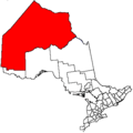
| District | Kenora |
| First Nation | Wabaseemoong |
| Area[1] | |
| • Land | 75.55 km2 (29.17 sq mi) |
| Population (2011)[1] | |
| • Total | 832 |
| • Density | 11.0/km2 (28/sq mi) |
Wabaseemoong is a First Nation reserve of the Wabaseemoong Independent Nations. It is in Kenora District, Ontario, Canada, close to the border with Manitoba. It used to be known as Islington 29.
References
- 1 2 "Wabaseemoong census profile". 2011 Census of Population. Statistics Canada. Retrieved 25 July 2015.
Places adjacent to Wabaseemoong | |
|---|---|
This article is issued from
Wikipedia.
The text is licensed under Creative Commons - Attribution - Sharealike.
Additional terms may apply for the media files.