Pelican, Ontario
| Pelican | |
| Settlement | |
| Country | Canada |
|---|---|
| Province | Ontario |
| Region | Northwestern Ontario |
| District | Kenora |
| Municipality | Sioux Lookout |
| Elevation | 375 m (1,230 ft) |
| Coordinates | 50°06′47″N 92°01′47″W / 50.11306°N 92.02972°WCoordinates: 50°06′47″N 92°01′47″W / 50.11306°N 92.02972°W |
| Timezone | Central Time Zone (UTC-6) |
| - summer (DST) | Central Time Zone (UTC-5) |
| Postal code FSA | P0V |
| Area code | 807 |
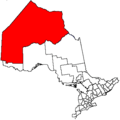
 Location of Pelican in Ontario | |
Pelican is an unincorporated settlement and railway point in the municipality of Sioux Lookout, Kenora District in northwestern Ontario, Canada.[1][2] It is located just south of Pelican Lake on the English River, part of the Nelson River drainage basin.
Pelican is on the Canadian National Railway transcontinental main line,[3] between Hudson to the west and the town centre of Sioux Lookout to the east, and is passed but not served by Via Rail transcontinental Canadian trains.
References
- ↑ "Pelican". Geographical Names Data Base. Natural Resources Canada. Retrieved 2011-08-17.
- ↑ "Sioux Lookout Boundary Map" (PDF). Town of Sioux Lookout. October 2010. Retrieved 2011-08-17.
- ↑ Map 13 (PDF) (Map). 1 : 1,600,000. Official road map of Ontario. Ministry of Transportation of Ontario. 2010-01-01. Retrieved 2011-08-17.
This article is issued from
Wikipedia.
The text is licensed under Creative Commons - Attribution - Sharealike.
Additional terms may apply for the media files.