Vrbno, Šentjur
| Vrbno | |
|---|---|
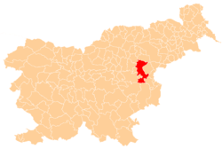
 Vrbno Location in Slovenia | |
| Coordinates: 46°12′57.12″N 15°22′20.1″E / 46.2158667°N 15.372250°ECoordinates: 46°12′57.12″N 15°22′20.1″E / 46.2158667°N 15.372250°E | |
| Country |
|
| Traditional region | Styria |
| Statistical region | Savinja |
| Municipality | Šentjur |
| Area | |
| • Total | 1.91 km2 (0.74 sq mi) |
| Elevation | 257.4 m (844.5 ft) |
| Population (2002) | |
| • Total | 409 |
| [1] | |
Vrbno (pronounced [ˈʋəɾbnɔ]) is a settlement in the Municipality of Šentjur in eastern Slovenia. It lies on the right bank of the Voglajna River on the regional road leading west out of Šentjur towards Celje. The area is part of the historical Styria region. The municipality is now included in the Savinja Statistical Region.[2]
References
- ↑ Statistical Office of the Republic of Slovenia
- ↑ "Šentjur municipal site". Archived from the original on 2011-01-15. Retrieved 2011-01-03.
External links
This article is issued from
Wikipedia.
The text is licensed under Creative Commons - Attribution - Sharealike.
Additional terms may apply for the media files.