Podgaj, Šentjur
| Podgaj Sveti Ožbalt (until 1955) | |
|---|---|
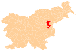
 Podgaj Location in Slovenia | |
| Coordinates: 46°14′33.91″N 15°27′4.12″E / 46.2427528°N 15.4511444°ECoordinates: 46°14′33.91″N 15°27′4.12″E / 46.2427528°N 15.4511444°E | |
| Country |
|
| Traditional region | Styria |
| Statistical region | Savinja |
| Municipality | Šentjur |
| Area | |
| • Total | 0.97 km2 (0.37 sq mi) |
| Elevation | 314.9 m (1,033.1 ft) |
| Population (2002) | |
| • Total | 90 |
| [1] | |
Podgaj (pronounced [pɔdˈɡaːi̯]) is a small settlement south of Ponikva in the Municipality of Šentjur in eastern Slovenia. Traditionally the area is part of Styria. The municipality is now included in the Savinja Statistical Region.[2]
Name
The name of the settlement was changed from Sveti Ožbalt (literally, 'Saint Oswald') to Podgaj (literally, 'below the grove') in 1955. The name was changed on the basis of the 1948 Law on Names of Settlements and Designations of Squares, Streets, and Buildings as part of efforts by Slovenia's postwar communist government to remove religious elements from toponyms.[3][4][5]
References
- ↑ Statistical Office of the Republic of Slovenia
- ↑ Šentjur municipal site Archived 2011-01-15 at the Wayback Machine.
- ↑ Spremembe naselij 1948–95. 1996. Database. Ljubljana: Geografski inštitut ZRC SAZU, DZS.
- ↑ Premk, F. 2004. Slovenska versko-krščanska terminologija v zemljepisnih imenih in spremembe za čas 1921–1967/68. Besedoslovne lastnosti slovenskega jezika: slovenska zemljepisna imena. Ljubljana: Slavistično društvo Slovenije, pp. 113–132.
- ↑ Urbanc, Mimi, & Matej Gabrovec. 2005. Krajevna imena: poligon za dokazovanje moči in odraz lokalne identitete. Geografski vestnik 77(2): 25–43.
External links
This article is issued from
Wikipedia.
The text is licensed under Creative Commons - Attribution - Sharealike.
Additional terms may apply for the media files.