Podpeč nad Marofom
| Podpeč nad Marofom | |
|---|---|
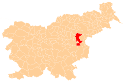
 Podpeč nad Marofom Location in Slovenia | |
| Coordinates: 46°6′21.84″N 15°22′51.88″E / 46.1060667°N 15.3810778°ECoordinates: 46°6′21.84″N 15°22′51.88″E / 46.1060667°N 15.3810778°E | |
| Country |
|
| Traditional region | Styria |
| Statistical region | Savinja |
| Municipality | Šentjur |
| Area | |
| • Total | 1.58 km2 (0.61 sq mi) |
| Elevation | 581.7 m (1,908.5 ft) |
| Population (2002) | |
| • Total | 31 |
| [1] | |
Podpeč nad Marofom (pronounced [pɔtˈpeːtʃ nat ˈmaːɾɔfɔm]) is a small settlement west of Planina pri Sevnici in the Municipality of Šentjur in eastern Slovenia. Historically the area was part of the Styria region. The municipality is now included in the Savinja Statistical Region.[2]
Name
The name of the settlement was changed from Podpeč to Podpeč nad Marofom in 1953.[3]
References
- ↑ Statistical Office of the Republic of Slovenia
- ↑ Šentjur municipal site Archived 2011-01-15 at the Wayback Machine.
- ↑ Spremembe naselij 1948–95. 1996. Database. Ljubljana: Geografski inštitut ZRC SAZU, DZS.
External links
This article is issued from
Wikipedia.
The text is licensed under Creative Commons - Attribution - Sharealike.
Additional terms may apply for the media files.