Doropolje
| Doropolje | |
|---|---|
 Doropolje Location in Slovenia | |
| Coordinates: 46°5′45.75″N 15°25′2.93″E / 46.0960417°N 15.4174806°ECoordinates: 46°5′45.75″N 15°25′2.93″E / 46.0960417°N 15.4174806°E | |
| Country |
|
| Traditional region | Styria |
| Statistical region | Savinja |
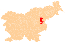
| Municipality | Šentjur |
| Area | |
| • Total | 5.41 km2 (2.09 sq mi) |
| Elevation | 608.9 m (1,997.7 ft) |
| Population (2002) | |
| • Total | 153 |
| [1] | |
Doropolje (pronounced [dɔˈɾoːpɔljɛ]) is a settlement south of Planina pri Sevnici in the Municipality of Šentjur in eastern Slovenia. The area was traditionally part of Styria and is now included in the Savinja Statistical Region.[2]
References
External links
This article is issued from
Wikipedia.
The text is licensed under Creative Commons - Attribution - Sharealike.
Additional terms may apply for the media files.