View Royal
| View Royal | |
|---|---|
| Town | |
| Town of View Royal[1] | |
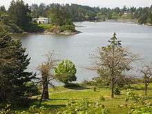
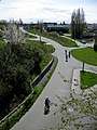
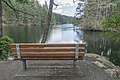
 Portage Park on Thetis Cove | |
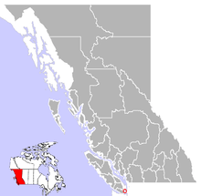 Location of View Royal in British Columbia | |
| Coordinates: 48°27′6″N 123°26′2″W / 48.45167°N 123.43389°WCoordinates: 48°27′6″N 123°26′2″W / 48.45167°N 123.43389°W | |
| Country |
|
| Province |
|
| Region | Vancouver Island |
| Regional district | Capital Regional District |
| Incorporated | 1988 |
| Government | |
| • Type | Municipal |
| • Governing body | View Royal Town Council |
| • Mayor | David Screech |
| Area[2] | |
| • Total | 14.36 km2 (5.54 sq mi) |
| Elevation | 20 m (70 ft) |
| Population (2016)[2] | |
| • Total | 10,408 |
| • Density | 724.8/km2 (1,877/sq mi) |
| Time zone | UTC-8 (PST) |
| • Summer (DST) | UTC-7 (PDT) |
| Postal code | V9B |
| Area code(s) | 250 |
| Highways |
|
| Waterways | Strait of Juan de Fuca |
| Website |
www |
View Royal is a town in Greater Victoria and a member municipality of the Capital Regional District of British Columbia, Canada. View Royal has a population of 10,858 residents. With over 700 hectares (1,700 acres) of parkland, View Royal includes McKenzie, Pike, Prior and Thetis Lakes and portions of the Esquimalt Harbour and Portage Inlet.
History
View Royal's history is closely linked to the entire region. The Esquimalt First Nation, a Coast Salish indigenous people, have occupied View Royal since time immemorial. It began when early inhabitants of today's Esquimalt Harbour crossed an isthmus, now Portage Park, to harvest seafood in Portage Inlet. European settlement began in the 1850s by Kenneth Mackenzie who established a farm known as Craigflower Manor.[3] In the mid-19th century, Dr. John Helmcken, Vancouver Island's first doctor and later speaker of the British Columbia Legislative Assembly, paid the Hudson's Bay Company $5 per acre for hundreds of acres of land between Esquimalt Harbour and what is now Victoria General Hospital. Land was cleared for Victoria's growth. In 1912, the Island Investment Company bought 80 acres (32 ha) of land below Four Mile Hill, fronting on the harbour, from Dr. Helmcken’s son James. They marketed lots as “View Royal” because of their "royal view", which gave the town its name.
View Royal remained unorganized for over half a century. By the 1950s, things had begun to change. In 1959, a group of residents in the Shoreline Drive area circulated a petition urging annexation by Esquimalt. Several studies and referenda came and went but View Royal continued with its unorganized status. In 1966, the Capital Regional District emerged bringing with it regional approaches for delivery of some services such as sewage collection. Then a Price Waterhouse study presented three options: status quo, union with Esquimalt, or incorporation as a town. The town’s incorporation became official December 5, 1988.
Many historic sites can still be found in View Royal including:
- Four Mile Pub & Six Mile Pub: two historic "road houses" or pubs that have existed for approximately 150 years.
- Craigflower Manor & Schoolhouse: one of Canada's National Historic Sites. Completed in 1856, the Manor site was one of four original farms set up by the Hudson's Bay Company as part of their obligations in settling Vancouver Island. The site housed the McKenzie family in the Manor as well as twenty other dwellings, a saw mill, a flour mill, a blacksmith's shop, a brick kiln, slaughterhouse and a general store. The Craigflower Schoolhouse, the companion adjacent site to the Manor, is located across a municipal border. The two properties are located at the intersection of Admirals Road, Craigflower Road and Island Highway.[4]
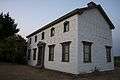 Craigflower Manor and Schoolhouse
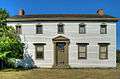 Craigflower Manor and Schoolhouse
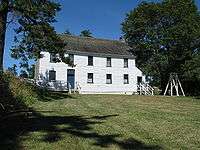 Craigflower Manor and Schoolhouse
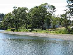 Gorge View
Present day
View Royal is divided into eight neighbourhoods based on topography, transportation corridors, natural environment and the age of housing stock. These neighbourhoods are Atkins, Burnside, Craigflower, Harbour, Helmcken, Hospital, Thetis and Wilfert. In 2011, there were almost 4,140 housing units in the town with a median population age of 44.1 years, which compares to the CRD's of 44.8.[5]
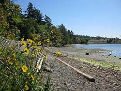
View Royal has 70 municipal parks and 25 kilometres (16 mi) of trails.[6] View Royal's shoreline includes sandy beaches with small caves, large driftwood and rocks, which are home to starfish, crabs, seals and other marine life.
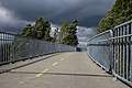
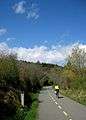
Several changes have gone on in View Royal in recent years, including the completion of the Island Highway Improvement Project in 2011, which included new cycle lanes, sidewalks, turning lanes, and planted medians.[7] Beginning in 2013, the Town of View Royal and District of Saanich replaced the 80-year-old Craigflower Bridge and approach roads,[8] and construction began on the new Public Safety Building, scheduled to be complete in fall 2014.[9]
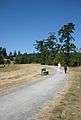
Local trails
The View Royal trail networks were designed to promote sustainable living and a source of recreation. Below are a list of some of the more well known trails found in View Royal.[10]
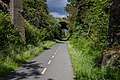
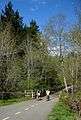
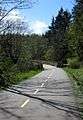
Galloping Goose
The Galloping Goose Regional Trail system is widely used for commuting for pedestrians and cyclists. "The Goose" connects Downtown Victoria to Sooke. There is a connection to the Lochside Trail that connects to Swartz Bay.
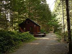
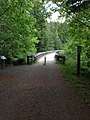
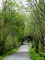
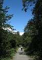
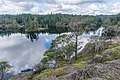
Thetis Lake Regional Trails
This recreational trail system is extensive with various levels of difficulty ranging from moderate to difficulties with several switchbacks that wrap around Thetis Lake and beyond. The trail has very scenic views around several lakes and west coast rainforest. Dog Friendly (but must be on leash), restrooms are along the trail[11]
 Lookout point
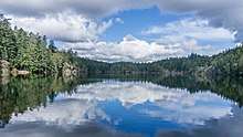
 Vista/Rest Point
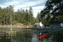 The Beach
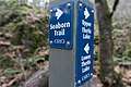 Crossroad marker
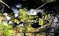
Duffus Trail
This trail runs along the shoreline of Mill Stream with very scenic views of beaches.
MacLennan Trail
This trail follows the Trans Canada Highway across Craigflower Creek and connects the View Royal Park trail system. This trail is accessible from the Trans Canada Highway/Helmcken Rd overpass.
 View Royal Trail
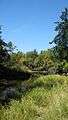 Craigflower Creek
Parsons Trail
This is a natural-state trail with mostly untouched lands along the Persons Cove inlet.
Chilco trails
A network of trails from Thetis Vale that reaches a viewing platform with one of the best lookouts in the entire region.
References
- ↑ "British Columbia Regional Districts, Municipalities, Corporate Name, Date of Incorporation and Postal Address" (XLS). British Columbia Ministry of Communities, Sport and Cultural Development. Retrieved November 2, 2014.
- 1 2 "View Royal, Town [Census subdivision], British Columbia and Capital, Regional district [Census division], British Columbia". Statistics Canada. January 23, 2017. Retrieved February 8, 2017.
- ↑ Craigflower Manor and Schoolhouse, B.C. Ministry of Tourism and Culture website retrieved 21-09-10
- ↑ http://www.viewroyal.ca/EN/main/discover/archives-heritage.html
- ↑ http://www12.statcan.gc.ca/census-recensement/2011/dp-pd/prof/details/page.cfm?Lang=E&Geo1=CSD&Code1=5917047&Geo2=CD&Code2=5917&Data=Count&SearchText=view%20royal&SearchType=Begins&SearchPR=59&B1=All&Custom=&TABID=1
- ↑ Annual Report - Year Ended 2013
- ↑ Annual Report - Year Ended 2011
- ↑ Craigflower Bridge Replacement Project Archived October 21, 2014, at the Wayback Machine.
- ↑ New Public Safety Building
- ↑ "View Royal - Trails". www.viewroyal.ca. Retrieved 2018-10-06.
- ↑ "Thetis Lake | Victoria Trails". Victoria Trails. Retrieved 2018-10-08.
External links
| Wikimedia Commons has media related to View Royal. |
- Town of View Royal
- Craigflower Bridge Replacement Project
- New Public Safety Building
- History of the Six Mile Pub
- View Royal Fastball Association
- https://twitter.com/townofviewroyal
- https://www.facebook.com/TownOfViewRoyal/
- https://www.youtube.com/user/TownofViewRoyal
| Subdivisions |  | |
|---|---|---|
| Communities | ||
| Metro areas and agglomerations | ||
| Towns | ||
| ||