Victoria County, Nova Scotia
| Victoria County | |
|---|---|
| County | |
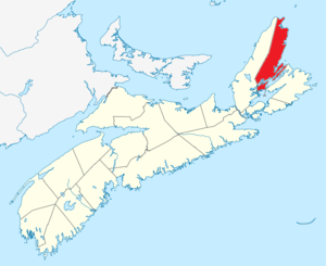 Location of Victoria County, Nova Scotia | |
| Coordinates: 46°24′N 60°36′W / 46.4°N 60.6°WCoordinates: 46°24′N 60°36′W / 46.4°N 60.6°W | |
| Country |
|
| Province |
|
| Founded | 1851 |
| Incorporated | April 17, 1879 |
| Electoral Districts Federal |
Sydney—Victoria |
| Provincial | Victoria-The Lakes |
| Government | |
| • Type | Victoria County Municipal Council |
| • Warden | Bruce J. Morrison |
| Area[1] | |
| • Land | 2,870.85 km2 (1,108.44 sq mi) |
| Population (2016)[1][2] | |
| • Total | 7,089 |
| • Density | 2.5/km2 (6/sq mi) |
| • Change 2011-16 |
|
| Time zone | UTC-4 (AST) |
| • Summer (DST) | UTC-3 (ADT) |
| Area code(s) | 902 |
| Dwellings | 4,437 |
| Median Income* | $44,134 CDN |
| Unemployment rate | 26.3% |
| Website | www.victoriacounty.com |
| |
Victoria County is a county in Nova Scotia, Canada. The shire town and largest municipality is the village of Baddeck.
History
Named after Queen Victoria, it was established by statute in 1851. Cape Breton County was divided into two counties in that year, with Victoria County being subdivided at that time.
Geography
There are several distinctive geographic regions in Victoria county: north of Smokey Mountain, south of Smokey Mountain, St. Ann's Bay, Boularderie Island, Baddeck, Middle River and the Washabuck Peninsula. The county is 2,768 square kilometers in size, 80% of which is covered by forest and the remainder largely by water.
Demographics
As a census division in the 2016 Census of Population conducted by Statistics Canada, Victoria County recorded a population of 7,089 living in 3,101 of its 4,437 total private dwellings, a change of −0.4% from its 2011 population of 7,115. With a land area of 2,857.74 km2 (1,103.38 sq mi), it had a population density of 2.5/km2 (6.4/sq mi) in 2016.[3]
Forming the majority of the Victoria County census division, the Municipality of the County of Victoria recorded a population of 6,552 living in 2,943 of its 4,271 total private dwellings in the 2016 Census of Population, a change of −0.7% from its 2011 population of 6,597. With a land area of 2,854.01 km2 (1,101.94 sq mi), it had a population density of 2.3/km2 (5.9/sq mi) in 2016.[4]
|
Mother tongue language (2011)[7]
|
Ethnic Groups (2006)[8]
|
The county's population has slowly declined over the last ten years and has also aged, with all age groups under the age of 65 experiencing net out-migration. Half of the county's labour force does not have a high school diploma, and only 5% have college educations.
Communities
- Villages
- Reserves
- County municipality and county subdivisions
- Municipality of the County of Victoria
- Victoria, Subd. A
- Victoria, Subd. B
Economy
71% of the workforce is employed in the services sector. An additional 18% are employed in the primary resources industry, a category that includes both forestry and fishing. Just 11% are employed in manufacturing, less than half of the levels seen in the 1960s.
Government and politics
The county is administered by a county government which is incorporated as the Municipality of the County of Victoria. The county is governed by eight councillors and a warden who oversee the work of a Chief Administrative Officer.
The federal Electoral Riding is Sydney—Victoria.
Features
Victoria County contains the eastern half of the Cape Breton Highlands National Park, as well as the Cabot Trail, whereas Inverness County contains the western half of these features. The county also contains St. Paul Island, known as the "Graveyard of the Gulf of St. Lawrence" for its many shipwrecks during the age of sail.
Access Routes
Highways and numbered routes that run through the county, including external routes that start or finish at the county limits:[9]
|
|
|
|
See also
References
- 1 2 2006 Statistics Canada Community Profile: Victoria County, Nova Scotia
- ↑ Statistics Canada Population and dwelling counts, for Canada and census subdivisions (municipalities), 2006 and 2001 censuses - 100% data
- ↑ "Population and dwelling counts, for Canada, provinces and territories, and census divisions, 2016 and 2011 censuses – 100% data (Nova Scotia)". Statistics Canada. February 8, 2017. Retrieved February 12, 2017.
- ↑ "Population and dwelling counts, for Canada, provinces and territories, and census subdivisions (municipalities), 2016 and 2011 censuses – 100% data (Nova Scotia)". Statistics Canada. February 8, 2017. Retrieved February 12, 2017.
- ↑ Censuses 1871-1941
- ↑ Statistics Canada: 1996, 2001, 2006 census
- ↑ Statistics Canada: 2011 census
- ↑ 2006 Statistics Canada Census Ethnocultural Portrait of Canada: Victoria County, Nova Scotia
- ↑ Atlantic Canada Back Road Atlas ISBN 978-1-55368-618-7 Pages 26-27, 40-41, 56-57
External links
| Wikimedia Commons has media related to Victoria County, Nova Scotia. |
- Municipality of Victoria County website
- Visit Victoria County Official Tourism website
- Central Cape Breton
- Visit Baddeck
- North Shore Community Portal
- Cape Breton Highlands
- Hike the Highlands Festival,
- Photographs of historic monuments in Victoria County
- Victoria County CAP Site Association
Places adjacent to Victoria County, Nova Scotia | |
|---|---|
| Historical counties | |
|---|---|
| Economic regions | |
| Regional municipalities | |
| County municipalities | |
| District municipalities | |
| Towns | |
| Villages | |
| Lists | |
| |