Cape Breton County
| Cape Breton County | |
|---|---|
| County | |
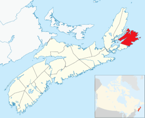 Location of Cape Breton County, Nova Scotia | |
| Coordinates: 46°00′N 60°18′W / 46.0°N 60.3°WCoordinates: 46°00′N 60°18′W / 46.0°N 60.3°W | |
| Country |
|
| Province |
|
| Municipality | Cape Breton Regional Municipality |
| Electoral Districts Federal |
Cape Breton—Canso / Sydney—Victoria |
| Provincial | Cape Breton Centre / Cape Breton North / Cape Breton Nova / Cape Breton South / Cape Breton West / Glace Bay |
| Government | |
| • Mayor-Warden | Cecil Clarke |
| • Council | Cape Breton Regional Council |
| Area | |
| • Total | 2,470.62 km2 (953.91 sq mi) |
| Population (2006) | |
| • Total | 109,330 |
| • Density | 44.3/km2 (115/sq mi) |
| Time zone | UTC-4 (AST) |
| Area code(s) | 902 |
| Median Earnings* | $40,451 |
Part of a series about Places in Nova Scotia | |
Cape Breton County is one of eighteen counties in the Canadian province of Nova Scotia. It is located on Cape Breton Island.
From 1879 to 1995, the area of the county excluded from towns and cities was incorporated as the Municipality of the County of Cape Breton to provide local government services. Since 1995 the only municipality in the county has been a single-tier municipality called Cape Breton Regional Municipality. For statistical purposes, the First Nations reserves of Eskasoni 3 and Membertou 28B are included in the county, but are separate entities.
History
Taking its name from Cape Breton, the most easterly point of the island which was called after the Bretons of Brittany, the county has what is probably the oldest surviving European name to have been used to designate part of North America.
By proclamation of October 17, 1763 after termination of the Seven Years' War, Cape Breton Island was formally annexed to Nova Scotia. For a time thereafter Cape Breton Island was part of Halifax County. On December 10, 1765, Cape Breton Island was set apart as a separate county under the name Cape Breton County.
From 1784 to 1820, Cape Breton Island was established as a separate colony with a Lieutenant Governor and a nominated Executive Council, but without an elected house of assembly. Not until after Cape Breton Island was re-annexed to Nova Scotia in 1820 did it receive representation in an elected legislature.
Although subdivided into three districts in 1824, Cape Breton County was co-extensive with Cape Breton Island from 1820 to 1835 when the county was divided into three separate and distinct counties:
- Cape Breton (Northeastern District)
- Richmond (Southern District) later called Richmond County
- Juste au Corps (Northwest District) later called Inverness County
In 1851, Victoria County was formed out of the northeastern part of Cape Breton County and a year later, in 1852, the present boundaries of Cape Breton County were defined by the colonial government in Halifax.
Demographics
As a census division in the 2016 Census of Population conducted by Statistics Canada, Cape Breton County recorded a population of 98,722 living in 43,081 of its 47,205 total private dwellings, a change of −2.9% from its 2011 population of 101,619. With a land area of 2,467.74 km2 (952.80 sq mi), it had a population density of 40.0/km2 (103.6/sq mi) in 2016.[1]
Transportation
Major highways
Municipal government
Cape Breton County had several incorporated municipalities within its boundaries:
- City of Sydney (1904-1995)
- Town of Glace Bay (1901-1995)
- Town of New Waterford (1913-1995)
- Town of North Sydney (1885-1995)
- Town of Sydney Mines (1889-1995)
- Town of Louisbourg (1901-1995)
- Town of Dominion (1906-1995)
- Municipality of the County of Cape Breton (1879-1995)
In the early 1990s the provincial government began to examine duplication of municipal services in Nova Scotia. One of the recommendations arising from this study was that all of Cape Breton County be amalgamated. On August 1, 1995 all seven municipal units in the county were dissolved and replaced by a single tier municipality called the Cape Breton Regional Municipality (CBRM).
The new regional municipality's boundary included all of Cape Breton County except for the Eskasoni and Membertou First Nations.
Cape Breton County continues to exist as a county in Nova Scotia, however all municipal government and service delivery is provided by either the Cape Breton Regional Municipality or the First Nations with no additional county level government or administration, nor any lower level town or city level government or administration.
Communities
- Regional municipalities
- Reserves
References
- ↑ "Population and dwelling counts, for Canada, provinces and territories, and census divisions, 2016 and 2011 censuses – 100% data (Nova Scotia)". Statistics Canada. February 8, 2017. Retrieved February 12, 2017.
External links
| Regional municipalities | | |
|---|---|---|
| First Nations | ||
| Indian reserves | ||
| Former municipalities | ||
| ||
| Historical counties | |
|---|---|
| Economic regions | |
| Regional municipalities | |
| County municipalities | |
| District municipalities | |
| Towns | |
| Villages | |
| Lists | |
| |