Cumberland County, Nova Scotia
| Cumberland County | |||
|---|---|---|---|
| County | |||
| |||
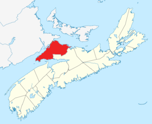 Location of Cumberland County, Nova Scotia | |||
| Coordinates: 45°42′N 64°06′W / 45.7°N 64.1°WCoordinates: 45°42′N 64°06′W / 45.7°N 64.1°W | |||
| Country |
| ||
| Province |
| ||
| Towns | Amherst / Oxford / Parrsboro | ||
| Established | August 17, 1759 | ||
| Incorporated | April 17, 1879 | ||
| Electoral Districts Federal |
Cumberland—Colchester —Musquodoboit Valley | ||
| Provincial | Cumberland North / Cumberland South | ||
| Government | |||
| • Type | Cumberland County Municipal Council | ||
| • Warden | Allison Gillis[1] | ||
| • MLA |
Elizabeth Smith-McCrossin (PCNS) Jamie Baillie (PCNS) | ||
| • MP | Bill Casey (LPC) | ||
| Area[2] | |||
| • Land | 4,277.86 km2 (1,651.69 sq mi) | ||
| Population (2016)[2][3] | |||
| • Total | 30,005 | ||
| • Density | 7.0/km2 (18/sq mi) | ||
| • Change 2011-16 |
| ||
| Time zone | UTC-4 (AST) | ||
| • Summer (DST) | UTC-3 (ADT) | ||
| Area code(s) | 902 | ||
| Dwellings | 18,445 | ||
| Median Income* | $38,433 CDN | ||
| Website | www.cumberland county.ns.ca | ||
| |||


Cumberland County is a county in the Canadian province of Nova Scotia.
History
The name Cumberland was applied by Lieutenant-Colonel Robert Monckton to the captured Fort Beauséjour on June 18, 1755 in honour of the third son of King George II, William Augustus, Duke of Cumberland, victor at Culloden in 1746 and Commander in Chief of the British forces. The Mi'kmaq name for the area was "Kwesomalegek" meaning "hardwood point".
Cumberland County was founded on August 17, 1759. When the Township of Parrsboro was divided in 1840, one part was annexed to Cumberland County and the other part annexed to Colchester.
The dividing line between Cumberland and Colchester was established in 1840. In 1897, a portion of the boundary line between the Counties of Colchester and Cumberland was fixed and defined. The county thrived in the 19th century with the development of lumbering, shipbuilding and coal mining. Deforestation and rural outmigration in the 20th century led to the abandonment of some communities such as Eatonville and New Yarmouth.
Geography

The county has a total area of 4,271.23 km2 (1,649.13 sq mi).
Cumberland County is rich in natural resources with extensive forest land supporting lumber mills and pulp contractors. It has many mineral resources, including 2 operating salt mines. Until the 1970s it also had several coal mines which extracted coal from seams that run from Joggins to River Hebert and on to Athol and Springhill.
Agriculture is concentrated on wild blueberry harvesting throughout the Cobequid Hills, as well as mixed farms located in the Tantramar Marshes region, the Northumberland Strait coastal plain, and the Wentworth Valley.
The northwestern edge of Cumberland County forms part of the Isthmus of Chignecto, the natural land bridge connecting the Nova Scotia peninsula to North America. As such, the county hosts several important transportation corridors, including Highway 104 (the Trans-Canada Highway) and CN Rail's Halifax-Montreal railway line.
Two towns are located in Cumberland County: Amherst and Oxford.
Demographics
As a census division in the 2016 Census of Population conducted by Statistics Canada, Cumberland County recorded a population of 30,005 living in 13,614 of its 18,445 total private dwellings, a change of −4.3% from its 2011 population of 31,353. With a land area of 4,277.86 km2 (1,651.69 sq mi), it had a population density of 7.0/km2 (18.2/sq mi) in 2016.[4]
Forming the majority of the Cumberland County census division, the Municipality of the County of Cumberland recorded a population of 19,402 living in 8,714 of its 13,103 total private dwellings in the 2016 Census of Population, a change of −5.3% from its 2011 population of 20,485. With a land area of 4,255.04 km2 (1,642.88 sq mi), it had a population density of 4.6/km2 (11.8/sq mi) in 2016.[5]
|
Mother tongue language (2011)[8]
|
Ethnic Groups (2006)[9]
|
Communities
- Towns
- Villages
- County municipality and county subdivisions
- Municipality of the County of Cumberland
- Cumberland Subdivision A
- Cumberland Subdivision B
- Cumberland Subdivision C
- Cumberland Subdivision D
Highways
See also
- List of municipalities in Nova Scotia
- Central Nova Tourist Association — Tourism Association Representing Cumberland County.
- Royal eponyms in Canada
- Black Lake listings within Nova Scotia.
References
- ↑ "Gillis elected warden for Cumberland County". Cumberland News Now. November 2, 2016. Retrieved July 18, 2017.
- 1 2 2006 Statistics Canada Community Profile: Cumberland County, Nova Scotia
- ↑ Statistics Canada Population and dwelling counts, for Canada and census subdivisions (municipalities), 2006 and 2001 censuses - 100% data
- ↑ "Population and dwelling counts, for Canada, provinces and territories, and census divisions, 2016 and 2011 censuses – 100% data (Nova Scotia)". Statistics Canada. February 8, 2017. Retrieved February 12, 2017.
- ↑ "Population and dwelling counts, for Canada, provinces and territories, and census subdivisions (municipalities), 2016 and 2011 censuses – 100% data (Nova Scotia)". Statistics Canada. February 8, 2017. Retrieved February 12, 2017.
- ↑ Censuses 1871-1941
- ↑ Statistics Canada: 1996, 2001, 2006 census
- ↑ Statistics Canada: 2011 census
- ↑ 2006 Statistics Canada Census Ethnocultural Portrait of Canada: Cumberland County, Nova Scotia
External links
| Wikimedia Commons has media related to Cumberland County, Nova Scotia. |
- Cumberland County official site
- Photographs of the Cumberland County War Memorial monument, Amherst
- Photographs of historic monuments in Cumberland County
Places adjacent to Cumberland County, Nova Scotia | ||||||||||
|---|---|---|---|---|---|---|---|---|---|---|
| ||||||||||
| Historical counties | |
|---|---|
| Economic regions | |
| Regional municipalities | |
| County municipalities | |
| District municipalities | |
| Towns | |
| Villages | |
| Lists | |
| |