Vasa, Minnesota
| Vasa, Minnesota | |
|---|---|
| Unincorporated community | |
 Vasa  Vasa | |
| Coordinates: 44°30′12″N 92°43′21″W / 44.50333°N 92.72250°WCoordinates: 44°30′12″N 92°43′21″W / 44.50333°N 92.72250°W | |
| Country | United States |
| State | Minnesota |
| County | Goodhue |
| Township | Vasa |
| Elevation | 1,043 ft (318 m) |
| Time zone | UTC-6 (Central (CST)) |
| • Summer (DST) | UTC-5 (CDT) |
| ZIP code | 55089 |
| Area code(s) | 651 |
| GNIS feature ID | 653622[1] |
Vasa is an unincorporated community in Vasa Township, Goodhue County, Minnesota, United States.
The community is nine miles east of Cannon Falls at the junction of State Highway 19 (MN 19) and County 7 Boulevard. It is within ZIP code 55089 based in Welch. Nearby places include Cannon Falls, Red Wing, Welch, and White Rock.
Vasa is 12 miles west-southwest of Red Wing.
References
Municipalities and communities of Goodhue County, Minnesota, United States | ||
|---|---|---|
| Cities | 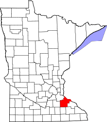 | |
| Townships | ||
| CDP | ||
| Unincorporated communities | ||
| Indian reservation | ||
| Ghost towns/Neighborhoods | ||
| Footnotes | ‡This populated place also has portions in an adjacent county or counties | |
This article is issued from
Wikipedia.
The text is licensed under Creative Commons - Attribution - Sharealike.
Additional terms may apply for the media files.