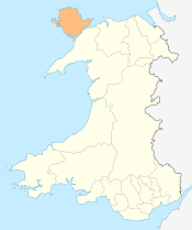
Valley, Anglesey
Valley is a village, community and former electoral ward near Holyhead on the west coast of Anglesey, North Wales. Population (2001) 2,413, decreasing to 2,361 at the 2011 census.[1]

In Welsh it is referred to as either Y Dyffryn (meaning The Valley) or [Y] Fali (pronounced as Valley). Recent research, prompted by local opposition to the name of Y Fali, suggested that Valley may be a corruption of the Irish Bally (settlement), or Baile as it is spelled in Irish. There does not appear to be a traditional Welsh language placename for the village, and thus there has been a reversion to Valley of late. There is no actual valley as the area is very flat, although a dip in the land was created when the Stanley Embankment to Holy Island was constructed, and this may be the origin of the name.
RAF Valley is a nearby Royal Air Force station concerned with the training of fast jet pilots. The runways are also used by Anglesey Airport who make commercial flights to Cardiff (and previously The Isle of Man). Valley railway station is on the North Wales Coast Line.
Prior to the 2012 Anglesey electoral boundary changes Valley was an electoral ward to the Isle of Anglesey County Council. It is now part of the larger Llifôn ward, together with Llanfaelog and Llanfair-yn-Neubwll.[2]
Climate
| Climate data for Valley (Anglesey) (1981–2010) | |||||||||||||
|---|---|---|---|---|---|---|---|---|---|---|---|---|---|
| Month | Jan | Feb | Mar | Apr | May | Jun | Jul | Aug | Sep | Oct | Nov | Dec | Year |
| Average high °C (°F) | 8.2 (46.8) |
8.1 (46.6) |
9.6 (49.3) |
11.8 (53.2) |
14.9 (58.8) |
17.1 (62.8) |
18.8 (65.8) |
18.8 (65.8) |
17.1 (62.8) |
14.1 (57.4) |
11.1 (52) |
8.7 (47.7) |
13.2 (55.8) |
| Average low °C (°F) | 3.6 (38.5) |
3 (37) |
4.5 (40.1) |
5.7 (42.3) |
8.2 (46.8) |
10.7 (51.3) |
12.8 (55) |
12.9 (55.2) |
11.4 (52.5) |
9 (48) |
6.3 (43.3) |
3.9 (39) |
7.7 (45.9) |
| Average precipitation mm (inches) | 75.5 (2.972) |
54.8 (2.157) |
62.8 (2.472) |
55.2 (2.173) |
48.4 (1.906) |
53.5 (2.106) |
54 (2.13) |
69.9 (2.752) |
71.5 (2.815) |
101.4 (3.992) |
103.5 (4.075) |
90.6 (3.567) |
841.1 (33.114) |
| Average precipitation days (≥ 1.0 mm) | 14.4 | 11.1 | 12 | 10.9 | 9.3 | 9.6 | 9.3 | 10.8 | 10.7 | 14.6 | 15.7 | 14.8 | 143 |
| Mean monthly sunshine hours | 62.3 | 86.5 | 123.1 | 177.8 | 231.8 | 207.8 | 201.1 | 189.5 | 146.7 | 109.7 | 63.6 | 51.6 | 1,651.4 |
| Source: metoffice [3] | |||||||||||||
References
- ↑ "Community/Ward population 2011". Retrieved 20 May 2015.
- ↑ "Isle of Anglesey (Electoral Arrangements) Order 2012" (PDF). legisaltion.gov.uk. The National Archives. Retrieved 6 December 2017.
- ↑ "Valley climate (Reference period 1981−2010)". 53.252, -4.537: Met Office UK. 2010. Retrieved 2015-11-09.
External links
![]()
| Wikivoyage has a travel guide for Valley (Anglesey). |
- Valley Community Council
- photos of Valley, Anglesey and surrounding area on geograph.org.uk
- Map sources for Valley, Anglesey
Coordinates: 53°17′02″N 4°33′43″W / 53.28401°N 4.56203°W