Four Mile Bridge
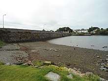
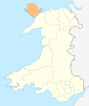
Four Mile Bridge (Welsh: Pontrhydybont / Pont-rhydbont / Pontrhypont) is a village and bridge across the Cymyran Strait in Wales. It connects Holy Island with Anglesey at a point approximately 3 miles (4.8 km) southeast of Holyhead and is one of three bridges between the two islands. The bridge is approximately 4 miles (6.4 km) from Holyhead via the old road route, giving the location its name. A bridge at this location was in existence by 1530,[1] and was the only land route to Holyhead until the construction of the Stanley Embankment in 1823. It is 120 metres (390 ft) long and carries the B4545 road over the Cymyran strait.
The village itself is quite small and is split between the two islands, the larger portion being on Holy Island. It is hard to get information on the population of the village as it is split between two communities. It is safe to say, however, that it must be around 500 as the largest part of the village is in the community of Rhoscolyn which has a population of 484, and there is no other settlement of any real size.[2]
The village is about 1 mile (1.6 km) from Valley railway station, and is on the Isle of Anglesey Coastal Path. The village has one cafe, Y Gegin Fach (meaning "the little kitchen"), a hairdressers and a pub named "The Anchorage".
References
External links
Coordinates: 53°16′27″N 4°34′51″W / 53.2743°N 4.5808°W