Benllech
| Benllech | |
|---|---|
 The sands at Benllech from the headland above Beach Road | |
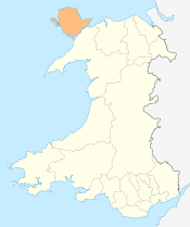
 Benllech Benllech shown within Anglesey | |
| Population | 3,382 |
| OS grid reference | SH518828 |
| Community | |
| Principal area | |
| Ceremonial county | |
| Country | Wales |
| Sovereign state | United Kingdom |
| Post town | TYN-Y-GONGL |
| Postcode district | LL74 |
| Dialling code | 01248 |
| Police | North Wales |
| Fire | North Wales |
| Ambulance | Welsh |
| EU Parliament | Wales |
| UK Parliament | |
| Welsh Assembly | |
Benllech is large village on the Isle of Anglesey in Wales. It is in the community of Llanfair Mathafarn Eithaf,[1] which has a population of 3,382, making it the 5th largest settlement by population on the island.[2] The name of Benllech village had been removed by the time of the 2011 census with the community being listed under Llanfair-Mathafarn-Eithaf with the electoral ward being listed under Llanddyfnan.
The name Benllech is perhaps a mutated form of penllech, literally "head slab" or "head rock", i.e. "capstone" or "head of the rock",[3] or possibly meaning 'on slate', shortened from the Welsh term 'ar ben llech'.
Benllech is a popular beach holiday destination. Winner of the European Blue Flag award since 2004, the beach shelves and has an abundance of clean yellow sand and looks out toward the Great Orme and Penmon Point. The Anglesey Coastal Path and Wales Coast Path pass through Benllech. The village won the 'tidiest village on Anglesey' competition in the years 1973–79 and was also awarded a Civic Trust Award which recognises the very best in architecture, design, planning, landscape and public art. The award was given to projects of the highest quality design, which have made a positive cultural, social and economic contribution to the local community.
The village has a range of businesses which include public houses and hotels, camping and caravan sites and several bed and breakfasts. The community has a primary school, Ysgol Goronwy Owen; library, doctors' surgery, chemist, several churches, hardware store, community centre, police and fire station, tennis court and bowling green, a number of supermarkets (Spar, Cooperative and Tesco Express) and a petrol service station. Between 1909 and 1950 there was a railway station close to the village which was the terminus of the Red Wharf Bay branch line. The old station house and several railway bridges can be seen along the road approaching the village.
Situated on the outskirts of Benllech lies the Scheduled Monument Pant-Y-Saer enclosed hut group, otherwise known as "Cytiau'r Gwyddelod" (Irish Huts). The monument consists of a complex of mainly circular huts and parts of an associated substantial enclosure wall lying on a slightly elevated limestone plateau area beside an old lane running from Llanbedrgoch to Llanfair Mathafarn Eithaf, about 0.6 km S of the modern settlement of Benllech. The monument is of national importance for its potential to enhance our knowledge of prehistoric/ Romano British settlement. It retains significant archaeological potential, with a strong probability of the presence of associated archaeological features and deposits. The structures themselves may be expected to contain archaeological information concerning chronology and building techniques. The scheduled area comprises the remains described and areas around them within which related evidence may be expected to survive. Source: Cadw.
Notable residents
- The poet Goronwy Owen (1723–1769) was a native of Llanfair Mathafarn Eithaf; the village hall, primary school and local football team are named after him.[4]
- Lemmy Kilmister, born Ian Fraser Kilmister, lead singer, bassist and guitarist of the band Motörhead, lived here from the age of 10 to the age of 16 (1956–1962).[5]
- Carwyn Ellis, lead singer for Colorama had a nomadic childhood before his family eventually settled in Benllech.
- Mathematician William Jones, who was the first to use the Greek letter π for the ratio of the circumference of a circle to its diameter, was born close by.
Location
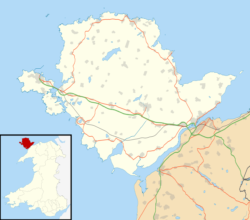
Benllech is located approximately 8 miles along the A5025 coast road from both bridges to the mainland and the A55 North Wales Expressway. The nearest mainline railway station is Llanfairpwllgwyngyll which can be reached in under half an hour on the bus services which run through the village or under 20 minutes by car. The City of Bangor is less than half an hour's drive away. The Royal Mail postal code for the area is LL74.
References
- ↑ Ordnance Survey : Election Maps : Isle of Anglesey Retrieved 2009-08-18
- ↑ Office for National Statistics : Census 2001 : Parish Headcounts : Isle of Anglesey Retrieved 2009-08-18
- ↑ BBC Wales: What's in a name?
- ↑ Davies, John; Jenkins, Nigel; Menna, Baines; Lynch, Peredur I., eds. (2008). The Welsh Academy Encyclopaedia of Wales. Cardiff: University of Wales Press. p. 638. ISBN 978-0-7083-1953-6.
- ↑ "Lemmy: Lead singer of the heavy metal band Motorhead". bbc.co.uk. Retrieved 19 June 2011.
External links
| Wikimedia Commons has media related to Benllech. |

- photos of Benllech and surrounding area on geograph
- Video of Benllech Past and Present by Dafydd Jones