Usme Formation
| Usme Formation Stratigraphic range: Late Eocene-Early Oligocene ~40–30 Ma | |
|---|---|
| Type | Geological formation |
| Underlies | Tilatá Formation |
| Overlies | Regadera Formation |
| Thickness | up to 300 m (980 ft) |
| Lithology | |
| Primary | Shale, sandstone, conglomerate |
| Location | |
| Coordinates | 4°21′40.3″N 74°07′50″W / 4.361194°N 74.13056°WCoordinates: 4°21′40.3″N 74°07′50″W / 4.361194°N 74.13056°W |
| Region |
Bogotá savanna, Altiplano Cundiboyacense Eastern Ranges, Andes |
| Country |
|
| Type section | |
| Named for | Usme |
| Named by | Hubach |
| Location | Usme, Bogotá |
| Year defined | 1957 |
| Coordinates | 4°21′40.3″N 74°07′50″W / 4.361194°N 74.13056°W |
| Region | Cundinamarca |
| Country |
|
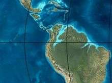 Paleogeography of Northern South America 35 Ma, by Ron Blakey | |
The Usme Formation (Spanish: Formación Usme, Tsu, Teu) is a geological formation of the Bogotá savanna, Altiplano Cundiboyacense, Eastern Ranges of the Colombian Andes. The formation consists of a lower part with predominantly shales with intercalated sandstone beds and an upper sequence with sandstones and conglomerates. The Usme Formation dates to the Neogene and Paleogene periods; Late Eocene to Early Oligocene epochs, and has a maximum thickness of 300 metres (980 ft).
Etymology
The formation was defined by Hubach in 1957 and named after the locality of Usme, Bogotá.[1]
Description
Lithologies
The Usme Formation is subdivided into a lower sequence of shales with intercalated sandstones and an upper part of sandstones and conglomerates.[1]
Stratigraphy and depositional environment
The Usme Formation unconformably overlies the Regadera Formation and is overlain by the Tilatá Formation.[2] The age has been estimated, based on palynological data, to be Late Eocene to Early Oligocene.[1] The depositional environment has been interpreted as marine with the upper part deposited in a deltaic setting.[3]
Outcrops
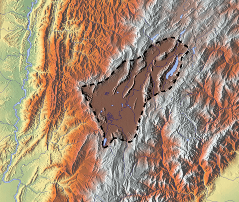
The Usme Formation is found in its type locality in the synclinal of Usme, the valley of the Tunjuelo River.[1]
See also
References
Bibliography
- Bayona, Germán; Omar Montenegro; Agustín Cardona; Carlos Jaramillo; Felipe Lamus; Sara Morón; Luiz Quiroz; María C. Ruíz, and Victor Valencia and Mauricio Parra. 2010. Estratigrafía, procedencia, subsidencia y exhumación de las unidades paleógenas en el Sinclinal de Usme, sur de la zona axial de la Cordillera Oriental - Stratigraphy, provenance, subsidence and exhumation of the Paleogene succession in the Usme Syncline, southern axial zone of the Eastern Cordillera. Geología Colombiana 35. 5-35. Accessed 2017-03-16.
- Guerrero Uscátegui, Alberto Lobo. 1992. Geología e Hidrogeología de Santafé de Bogotá y su Sabana, 1–20. Sociedad Colombiana de Ingenieros.
- Montoya Arenas, Diana María, and Germán Alfonso Reyes Torres. 2005. Geología de la Sabana de Bogotá, 1–104. INGEOMINAS.
Maps
- Acosta, Jorge E., and Carlos E. Ulloa. 1998. Plancha 246 - Fusagasugá - 1:100,000, 1. INGEOMINAS. Accessed 2017-06-06.
External links
- Gómez, J.; N.E. Montes; Á. Nivia, and H. Diederix. 2015. Plancha 5-09 del Atlas Geológico de Colombia 2015 – escala 1:500,000, 1. Servicio Geológico Colombiano. Accessed 2017-03-16.