Upper Siang district
| Upper Siang district | |
|---|---|
| District of Arunachal Pradesh | |
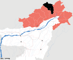 Location of Upper Siang district in Arunachal Pradesh | |
| Country | India |
| State | Arunachal Pradesh |
| Headquarters | Yingkiong |
| Area | |
| • Total | 6,188 km2 (2,389 sq mi) |
| Population (2011) | |
| • Total | 35,289[1] |
| Demographics | |
| • Literacy | 60.0%[1] |
| • Sex ratio | 891[1] |
| Website | Official website |
Upper Siang (Pron:/ˈsjæŋ or ˈsɪæŋ/) is an administrative district in the state of Arunachal Pradesh in India. It is the fourth least populous district in the country (out of 640).[2]
History
Majority of the people are Adi of tribe while the Memba, Khamba Idu Mishmi tribe also exist there. There are 7 plants in the district. The district was formed in 1999 when it was split from East Siang district.[3]
Geography
The district headquarters are located at Yingkiong. Upper Siang district occupies an area of 6,118 square kilometres (2,362 sq mi),[4]
The district is the location of the massive Upper Siang Hydroelectric Project.
Transport
The 2,000-kilometre-long (1,200 mi) proposed Mago-Thingbu to Vijaynagar Arunachal Pradesh Frontier Highway along the McMahon Line,[5][6][7][8] (will intersect with the proposed East-West Industrial Corridor Highway) and will pass through this district, alignment map of which can be seen here and here.[9]
Divisions
There are two Arunachal Pradesh Legislative Assembly constituencies in this district: Tuting-Yingkiong and Mariyang-Geku. Both are part of Arunachal East Lok Sabha constituency.[10]
Demographics
According to the 2011 census Upper Siang district has a population of 35,320,[11] roughly equal to the nation of Liechtenstein.[12] This gives it a ranking of 637th in India (out of a total of 640).[11] The district has a population density of 5 inhabitants per square kilometre (13/sq mi) .[11] Its population growth rate over the decade 2001–2011 was 5.77%.[11] Upper Siang has a sex ratio of 891 females for every 1000 males,[11] and a literacy rate of 59.94%.[11]
Various tribal groups of the Adi people and the Memba tribe live in the district. The Adi follow generally follow Donyi-Polo, and the Memba are followers of Tibetan Buddhism.
Languages
Languages spoken include Adi, a Sino-Tibetan tongue with approximately 140 000 speakers, written in both the Tibetan and Latin scripts.[13]
Flora and fauna
In 1986 Upper Siang district became home to Mouling National Park, which has an area of 483 km2 (186.5 sq mi).[14] A new mammal to science, Mebo giant flying squirrel (Petaurista siangensis) has been reported from this district[15]
References
- 1 2 3 "District Census 2011". Census2011.co.in.
- ↑ "District Census 2011". Census2011.co.in. 2011. Retrieved 2011-09-30.
- ↑ Law, Gwillim (25 September 2011). "Districts of India". Statoids. Retrieved 2011-10-11.
- ↑ Srivastava, Dayawanti et al. (ed.) (2010). "States and Union Territories: Arunachal Pradesh: Government". India 2010: A Reference Annual (54th ed.). New Delhi, India: Additional Director General, Publications Division, Ministry of Information and Broadcasting (India), Government of India. p. 1113. ISBN 978-81-230-1617-7.
- ↑ "Top officials to meet to expedite road building along China border". Dipak Kumar Dash. timesofindia.indiatimes.com. Retrieved 27 October 2014.
- ↑ "Narendra Modi government to provide funds for restoration of damaged highways". http://www.dnaindia.com. Retrieved 27 October 2014. External link in
|publisher=(help) - ↑ "Indian Government Plans Highway Along Disputed China Border". Ankit Panda. thediplomat.com. Retrieved 27 October 2014.
- ↑ "Govt planning road along McMohan line in Arunachal Pradesh: Kiren Rijiju". Live Mint. Retrieved 2014-10-26.
- ↑ "China warns India against paving road in Arunachal". Ajay Banerjee. tribuneindia.com. Retrieved 2014-10-26.
- ↑ "Assembly Constituencies allocation w.r.t District and Parliamentary Constituencies". Chief Electoral Officer, Arunachal Pradesh website. Archived from the original on 13 August 2011. Retrieved 21 March 2011.
- 1 2 3 4 5 6 "District Census 2011". Census2011.co.in. 2011. Retrieved 2011-09-30.
- ↑ US Directorate of Intelligence. "Country Comparison:Population". Retrieved 2011-10-01.
212 Liechtenstein 35,236 July 2011 est.
- ↑ M. Paul Lewis, ed. (2009). "Adi: A language of India". Ethnologue: Languages of the World (16th ed.). Dallas, Texas: SIL International. Retrieved 2011-09-28.
- ↑ Indian Ministry of Forests and Environment. "Protected areas: Arunachal Pradesh". Archived from the original on 23 August 2011. Retrieved 25 September 2011.
- ↑ Choudhury, A.U. (2013). Description of a new species of giant flying squirrel of the genus Petaurista Link, 1795 from Siang Basin, Arunachal Pradesh in North East India. The NL & Journal of the Rhino Foundation for nat. in NE India 9: 30–38, plates.
External links
Places adjacent to Upper Siang district | ||||||||||
|---|---|---|---|---|---|---|---|---|---|---|
| ||||||||||
Coordinates: 28°36′37″N 95°02′51″E / 28.61037°N 95.047531°E