Ulleung County
| Ulleung 울릉군 | ||
|---|---|---|
| County | ||
| Korean transcription(s) | ||
| • Hangul | 울릉군 | |
| • Hanja | 鬱陵郡 | |
| • Revised Romanization | Ulleung-gun | |
| • McCune-Reischauer | Ullŭng-gun | |
| ||
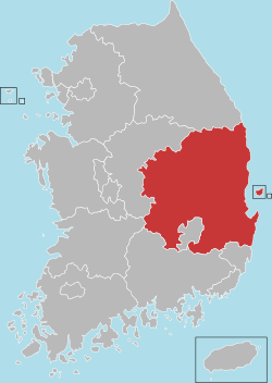
 Location in South Korea | ||
| Country | South Korea | |
| Region | Yeongnam | |
| Administrative divisions | 1 eup, 2 myeon | |
| Area | ||
| • Total | 72.518 km2 (27.999 sq mi) | |
| Population | ||
| • Total | 10,426 | |
| • Density | 143.8/km2 (372/sq mi) | |
| • Dialect | Gyeongsang | |
Ulleung County (Ulleung-gun) is a county in North Gyeongsang Province, South Korea. It consists mainly of the island of Ulleungdo, but is held to cover a total of 44 islands, including the Liancourt Rocks, which is contested by Japan and North Korea. All of these islands lie within the East sea.
Administratively, the county is divided into one eup and two myeon: Ulleung-eup (including Liancourt Rocks), Buk-myeon, and Seo-myeon. These in turn are divided into 10 legal ri, those into 25 administrative ri, and at the most basic level the county is held to contain 56 "natural villages."[1]
History
At the year of 512, Jijeung of Silla conquered Usan-guk which was the original nation in Ulleung-do. After a downfall of Silla, Goryeo naturally took the title of Ulleung. In 930, 13th year of Taejo of Goryeo, he granted local people bringing a tribute.
Hyeonjong of Goryeo sent his ambassador to islands for recovering ruined farming land in 1012.
Location
It is located in the middle of the East Sea between the Korean Peninsula and Japan. There are two main ports that provide ferries to Ulleung and Liancourt Rocks: Pohang Port and Mukho Port. These two ports offer regular shipping service.[2]
Administrative divisions
Ulleung-gun is divided into one eup and two myeon. Ulleung-eup is then divided into four legal ri, but six administrative ri. Buk-myeon is divided into three legal ri, eight administrative ri. Seo-myeon is divided into three legal ri, five administrative ri.
- Ulleung-eup (울릉읍/鬱陵邑): Dodong 1-ri (도동1리/道洞一里), Dodong 2-ri (도동2리/道洞二里), Dodong 3-ri (도동3리/道洞三里), Jeodong-ri (저동리/苧洞里), Sadong-ri (사동리/沙洞里), Dokdo-ri (독도리/獨島里)
- Buk-myeon (북면/北面): Cheonbu 1-ri (천부1리/天府一里), Cheonbu 2-ri (천부2리/天府二里), Cheonbu 3-ri (천부3리/天府三里), Cheonbu 4-ri (천부4리/天府四里), Na-ri (나리/羅里), Nari 1-ri (나리1리/羅里一里), Nari 2-ri (나리2리/羅里二里), Hyeonpo-ri (현포리/玄圃里)
- Seo-myeon (서면/西面): Namyang 1-ri (남양1리/南陽一里), Namyang 2-ri (남양2리/南陽二里), Namyang 3-ri (남양3리/南陽三里), Namseo-ri (남서리/南西里), Taeha-ri (태하리/台霞里)
Snowflower Festival
Ulleung County, which has one of the highest snowfalls in all of Korea, hosts the Snowflower Festival. In 2007, Ulleung had lot of snow, up to 42 cm (16.5 in) around coastlines and 105 cm (around 3 ft 5in) in the Nari Basin.[3] But the county did not host its festival before 2006 as there was not enough snow.[4]
Symbols
- Tree: Machilus thunbergii[5]
- Flower: camelliar flower
- Bird: wood pigeon
Climate
| Climate data for Ulleung (1981–2010, extremes 1938–present) | |||||||||||||
|---|---|---|---|---|---|---|---|---|---|---|---|---|---|
| Month | Jan | Feb | Mar | Apr | May | Jun | Jul | Aug | Sep | Oct | Nov | Dec | Year |
| Record high °C (°F) | 14.9 (58.8) |
19.2 (66.6) |
21.8 (71.2) |
26.1 (79) |
29.4 (84.9) |
32.2 (90) |
34.6 (94.3) |
34.6 (94.3) |
32.4 (90.3) |
27.2 (81) |
23.2 (73.8) |
17.9 (64.2) |
34.6 (94.3) |
| Average high °C (°F) | 4.3 (39.7) |
5.3 (41.5) |
9.1 (48.4) |
15.1 (59.2) |
19.3 (66.7) |
22.2 (72) |
25.2 (77.4) |
26.7 (80.1) |
23.1 (73.6) |
18.8 (65.8) |
13.1 (55.6) |
7.5 (45.5) |
15.8 (60.4) |
| Daily mean °C (°F) | 1.4 (34.5) |
2.2 (36) |
5.4 (41.7) |
11.1 (52) |
15.5 (59.9) |
18.8 (65.8) |
22.3 (72.1) |
23.6 (74.5) |
19.8 (67.6) |
15.3 (59.5) |
9.7 (49.5) |
4.4 (39.9) |
12.4 (54.3) |
| Average low °C (°F) | −0.8 (30.6) |
−0.2 (31.6) |
2.5 (36.5) |
7.7 (45.9) |
12.1 (53.8) |
16.0 (60.8) |
20.0 (68) |
21.4 (70.5) |
17.4 (63.3) |
12.6 (54.7) |
7.1 (44.8) |
2.0 (35.6) |
9.8 (49.6) |
| Record low °C (°F) | −11.6 (11.1) |
−13.6 (7.5) |
−9.9 (14.2) |
−2.7 (27.1) |
3.8 (38.8) |
7.0 (44.6) |
12.5 (54.5) |
14.7 (58.5) |
8.9 (48) |
0.7 (33.3) |
−5.9 (21.4) |
−9.6 (14.7) |
−13.6 (7.5) |
| Average precipitation mm (inches) | 116.2 (4.575) |
78.1 (3.075) |
72.2 (2.843) |
81.3 (3.201) |
105.1 (4.138) |
115.3 (4.539) |
170.2 (6.701) |
167.9 (6.61) |
170.7 (6.72) |
83.9 (3.303) |
105.5 (4.154) |
117.1 (4.61) |
1,383.4 (54.465) |
| Average precipitation days (≥ 0.1 mm) | 18.5 | 14.6 | 11.6 | 8.3 | 8.7 | 9.1 | 12.1 | 11.5 | 9.9 | 9.0 | 12.4 | 16.9 | 142.6 |
| Average snowy days | 17.9 | 13.3 | 7.0 | 0.7 | 0.0 | 0.0 | 0.0 | 0.0 | 0.0 | 0.3 | 3.6 | 12.1 | 54.9 |
| Average relative humidity (%) | 70.1 | 69.6 | 69.8 | 69.2 | 72.1 | 80.4 | 85.9 | 85.0 | 80.3 | 72.5 | 68.6 | 68.5 | 74.3 |
| Mean monthly sunshine hours | 90.4 | 104.1 | 167.2 | 212.0 | 227.3 | 175.0 | 150.7 | 163.3 | 158.7 | 176.8 | 130.0 | 100.6 | 1,856.1 |
| Percent possible sunshine | 29.5 | 34.2 | 45.1 | 53.7 | 51.7 | 39.7 | 33.6 | 38.8 | 42.5 | 50.7 | 42.6 | 33.7 | 41.7 |
| Source: Korea Meteorological Administration. Average[6] Record high[7] Record low[8] Percent sunshine and snowy days[9] | |||||||||||||
Twin towns and sister cities
Ulleung is twinned with:
References
- ↑ "Ulleung County Administrative District". ulleung.go.kr (in Korean). Retrieved 2018-05-19.
- ↑ "Archived copy". Archived from the original on 2007-11-17. Retrieved 2008-01-26.
- ↑ Nice to see you, Snow! 눈꽃축제 울릉 반갑다! 폭설 http://www.imaeil.com/sub_news/sub_news_view.php?news_id=2674&yy=2008
- ↑ Ulleung county worries 2 year long lack of snowfall <설국(雪國) 울릉도 2년째 눈 부족 '속타네'> 연합뉴스 2008-01-14 http://news.naver.com/main/read.nhn?mode=LSD&mid=sec&sid1=103&oid=001&aid=0001892877
- ↑ "울릉군 상징물" [Ulleung Symbol]. ulleung.go.kr (in Korean). Retrieved 2018-05-19.
- ↑ "평년값자료(30년) 울릉도(115)". Korea Meteorological Administration. Retrieved 2011-06-14.
- ↑ "기후자료극값(최대값) 8월 일최고기온 (℃) 최고순위, 115 울릉도". Korea Meteorological Administration. Retrieved 2011-06-14.
- ↑ "기후자료극값(최대값) 2월 일최저기온 (℃) 최저순위, 115 울릉도". Korea Meteorological Administration. Retrieved 2011-06-14.
- ↑ "Climatological Normals of Korea" (PDF). Korea Meteorological Administration. 2011. p. 499 and 649. Archived from the original (PDF) on 7 December 2016. Retrieved 9 December 2016.
External links
Andong (capital) | ||||
 | Specific city |
| ||
| Cities | ||||
| Counties | ||||
Coordinates: 37°29′00″N 130°54′00″E / 37.4833333433°N 130.90000001°E
| Authority control |
|---|