Bonghwa County
| Bonghwa 봉화군 | ||
|---|---|---|
| County | ||
| Korean transcription(s) | ||
| • Hangul | 봉화군 | |
| • Hanja | 奉化郡 | |
| • Revised Romanization | Bonghwa-gun | |
| • McCune-Reischauer | Ponghwa-gun | |
| ||
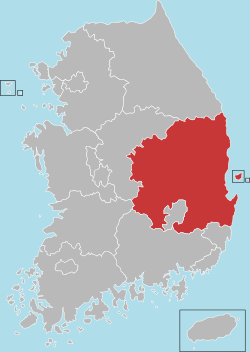
 Location in South Korea | ||
| Country |
| |
| Region | Yeongnam | |
| Administrative divisions | 1 eup, 9 myeon | |
| Area | ||
| • Total | 1,201 km2 (464 sq mi) | |
| Population | ||
| • Total | 41,452 | |
| • Density | 34.5/km2 (89/sq mi) | |
| • Dialect | Gyeongsang | |
Bonghwa County (Bonghwa-gun) is a county in North Gyeongsang Province, South Korea. It lies inland, at the northern edge of the province, and borders Gangwon province to the north. To the east it is bounded by Yeongyang and Uljin counties, to the south by Andong, and to the west by Yeongju. The county is ringed by the Taebaek and Sobaek Mountains, the highest of which is Taebaek-san itself, at more than 1500 meters above sea level. Because of this mountainous inland location, Bonghwa has a colder climate than most of the province, with an average annual temperature of 10 °C (50 °F).
Bonghwa is connected to the national rail grid by the Yeongdong Line, which stops at Bonghwa Station on its way between Yeongju and Gangneung. The Yeongdong Line, which is not known for its speed, stops at a total of 13 stations as it winds through Bonghwa, before ambling north into the next province.
Korean National Treasure No. 201, a rock-carved seated Buddhist statue, is located in Bukji-ri, Murya-myeon.
Famous people from Bonghwa include director Kim Ki-duk. The county is also the setting of the 2008 documentary film Old Partner, which has won numerous awards for its portrayal of rural life.
Administrative divisions

Bonghwa is divided into ten primary divisions: one eup (large village) and nine rural districts (myeon).
- Bonghwa-eup
- Beopjeon-myeon
- Bongseong-myeon
- Chunyang-myeon
- Jaesan-myeon
- Murya-myeon
- Myeongho-myeon
- Sangun-myeon
- Seokpo-myeon
- Socheon-myeon
The eup and myeon are further divided into numerous small villages (ri).
- Bonghwa-eup (봉화읍) - Samgye-ri (삼계리), Yugok-ri 유곡리, Geochon-ri (거촌리), Seokpyeong-ri (석평리), Haejeo-ri (해저리), Jeokdeok-ri (적덕리), Hwacheon-ri (화천리), Dochon-ri (도촌리), Mundan-ri (문단리), Naeseong-ri (내성리)
- Beopjeon-myeon (법전면) - Beopjeon-ri (법전리), Pongjeong-ri (풍정리), Cheokgok-ri (척곡리), Socheon-ri (소천리), Nulsan-ri (눌산리), Eoji-ri (어지리), Soji-ri (소지리)
- Bongseong-myeon (봉성면) - Bongseong-ri (봉성리), Oesam-ri (외삼리), Changpyeong-ri (창평리), Dongyang-ri (동양리), Geumbong-ri (금봉리), Ugok-ri (우곡리), Bongyang-ri (봉양리)
- Chunyang-myeon (춘양면) - Uiyang-ri (의양리), Haksan-ri (학산리), Seodong-ri (서동리), Seokhyeon-ri (석현리), Aedang-ri (애당리), Dosim-ri (도심리), Seobyeok-ri (서벽리), Uguchi-ri (우구치리), Soro-ri (소로리)
- Jaesan-myeon (재산면) - Hyeondong-ri (현동리), Nammyeon-ri (남면리), Dongmyeon-ri (동면리), Galsan-ri (갈산리), Sang-ri (상리)
- Murya-myeon (물야면) - Orok-ri (오록리), Gapyeong-ri (가평리), Gaedan-ri (개단리), Ujan-ri (오전리), Apdong-ri (압동리), Dumun-ri (두문리), Susik-ri (수식리), Bukji-ri (북지리)
- Myeongho-myeon (명호면) - Docheon-ri (도천리), Samdong-ri (삼동리), Yangguk-ri (양곡리), Gogam-ri (고감리), Pungho-ri (풍호리), Gogye-ri (고계리), Bokgok-ri (북곡리), Gwanchang-ri (관창리)
- Sangun-myeon (상운면) - Gagok-ri (가곡리), Ungye-ri (운계리), Munchon-ri (문촌리), Hanul-ri (하눌리), Toil-ri (토일리), Gocheon-ri (구천리), Seolmae-ri (설매리), Sinra-ri (신라리)
- Seokpo-myeon (석포면) - Seokpo-ri (석포리), Daehyeon-ri (대현리), Seungbu-ri (승부리)
- Socheon-myeon (소천면) - Hyeondong-ri (현동리), Goseon-ri (고선리), Imgi-ri (임기리), Dueum-ri (두음리), Seocheon-ri (서천리), Namhoeryong-ri (남회룡리), Buncheon-ri (분천리)
Climate
| Climate data for Bonghwa (1981–2010) | |||||||||||||
|---|---|---|---|---|---|---|---|---|---|---|---|---|---|
| Month | Jan | Feb | Mar | Apr | May | Jun | Jul | Aug | Sep | Oct | Nov | Dec | Year |
| Average high °C (°F) | 3.2 (37.8) |
6.0 (42.8) |
10.9 (51.6) |
18.4 (65.1) |
23.1 (73.6) |
26.4 (79.5) |
28.0 (82.4) |
28.6 (83.5) |
24.7 (76.5) |
19.7 (67.5) |
12.2 (54) |
5.6 (42.1) |
17.2 (63) |
| Daily mean °C (°F) | −3.9 (25) |
−1.5 (29.3) |
3.4 (38.1) |
9.9 (49.8) |
15.2 (59.4) |
19.4 (66.9) |
22.6 (72.7) |
22.8 (73) |
17.8 (64) |
10.9 (51.6) |
4.0 (39.2) |
−1.9 (28.6) |
9.9 (49.8) |
| Average low °C (°F) | −10.3 (13.5) |
−8.2 (17.2) |
−3.2 (26.2) |
1.8 (35.2) |
7.6 (45.7) |
13.2 (55.8) |
18.3 (64.9) |
18.2 (64.8) |
12.4 (54.3) |
4.0 (39.2) |
−2.6 (27.3) |
−8.3 (17.1) |
3.6 (38.5) |
| Average precipitation mm (inches) | 21.1 (0.831) |
28.4 (1.118) |
53.1 (2.091) |
75.3 (2.965) |
105.7 (4.161) |
157.4 (6.197) |
296.5 (11.673) |
242.0 (9.528) |
148.7 (5.854) |
36.5 (1.437) |
34.6 (1.362) |
18.6 (0.732) |
1,217.9 (47.949) |
| Average precipitation days (≥ 0.1 mm) | 6.0 | 5.7 | 7.5 | 7.5 | 8.7 | 10.5 | 15.2 | 13.7 | 9.2 | 5.1 | 5.7 | 5.1 | 99.9 |
| Average relative humidity (%) | 65.4 | 64.0 | 63.7 | 59.6 | 65.4 | 70.9 | 78.3 | 77.8 | 76.3 | 73.2 | 69.8 | 67.3 | 69.3 |
| Mean monthly sunshine hours | 182.4 | 179.3 | 198.4 | 223.5 | 229.6 | 197.2 | 145.8 | 163.6 | 158.2 | 189.0 | 172.1 | 180.4 | 2,223.6 |
| Source: Korea Meteorological Administration[1] | |||||||||||||
Twin towns – sister cities
Bonghwa is twinned with:
See also
References
- ↑ "평년값자료(1981–2010) 봉화(271)". Korea Meteorological Administration. Retrieved 2011-05-02.
External links
| Wikimedia Commons has media related to Bonghwa. |
Andong (capital) | ||||
 | Specific city |
| ||
| Cities | ||||
| Counties | ||||
Coordinates: 36°53′26″N 128°44′11″E / 36.89057°N 128.736455°E