Trảng Bom District
| Trảng Bom District Huyện Trảng Bom | |
|---|---|
| Rural district | |
| Country |
|
| Region | Southeast |
| Province | Đồng Nai |
| Capital | Trảng Bom |
| Area | |
| • Total | 126 sq mi (326 km2) |
| Population (2003) | |
| • Total | 192,627 |
| Time zone | UTC+7 (UTC + 7) |
Trảng Bom is a rural district of Đồng Nai Province in the Southeast region of Vietnam. Located on the National Highway 1, Trảng Bom was the site of fierce fighting in April 1975, prior to the fall of Saigon and the end of the Republic of Vietnam.
As of 2003 the district had a population of 192,627.[1] The district covers an area of 326 km². The district capital lies at Trảng Bom.[1]
In the district there are 16 municipalities:
- An Viễn
- Bàu Hàm 1
- Bắc Sơn
- Bình Minh, Trảng Bom
- Cây Gáo
- Đông Hòa
- Đồi 61
- Giang Điền
- Hố Nai 3
- Hưng Thịnh
- Quảng Tiến
- Sông Thao
- Sông Trầu
- Tây Hòa
- Thanh Bình
- Trung Hòa
References
- 1 2 "Districts of Vietnam". Statoids. Retrieved March 13, 2009.
| Ho Chi Minh City※ | 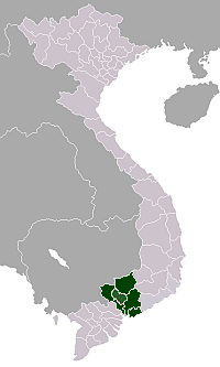 | |
|---|---|---|
| Bà Rịa-Vũng Tàu Province | ||
| Bình Dương Province |
| |
| Bình Phước Province |
| |
| Đồng Nai Province | ||
| Tây Ninh Province | ||
※ denotes provincial seat. | ||
Coordinates: 10°57′13″N 107°00′21″E / 10.95361°N 107.00583°E
This article is issued from
Wikipedia.
The text is licensed under Creative Commons - Attribution - Sharealike.
Additional terms may apply for the media files.