Định Quán District
| Định Quán District Huyện Định Quán | |
|---|---|
| Rural district | |
| Country |
|
| Region | Southeast |
| Province | Đồng Nai |
| Area | |
| • Total | 373 sq mi (967 km2) |
| Population (2003) | |
| • Total | 214,321 |
| Time zone | UTC+7 (UTC + 7) |
Định Quán is a rural district of Đồng Nai Province in the Southeast region of Vietnam. As of 2003 the district had a population of 214,321.[1] The district covers an area of 967 km². The district capital lies at Định Quán.[1]
Administrative subdivisions
This district is mostly rural, with the following xã:
- Định Quán town (thị trấn)
- Xã Thanh Sơn
- Xã Phú Tân
- Xã Phú Vinh
- Xã Ngọc Định
- Xã La Ngà
- Xã Phú Lợi
- Xã Phú Hoà
- Xã Gia Canh
- Xã Phú Ngọc
- Xã Túc Trưng
- Xã Phú Cường
- Xã Phú Túc
- Xã Suối Nho.
References
- 1 2 "Districts of Vietnam". Statoids. Retrieved March 13, 2009.
| Ho Chi Minh City※ | 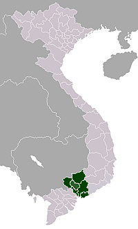 | |
|---|---|---|
| Bà Rịa-Vũng Tàu Province | ||
| Bình Dương Province |
| |
| Bình Phước Province |
| |
| Đồng Nai Province | ||
| Tây Ninh Province | ||
※ denotes provincial seat. | ||
Coordinates: 11°12′14″N 107°21′31″E / 11.2038°N 107.3587°E
This article is issued from
Wikipedia.
The text is licensed under Creative Commons - Attribution - Sharealike.
Additional terms may apply for the media files.