Bù Đốp District
| Bù Đốp District Huyện Bù Đốp | |
|---|---|
| Rural district | |
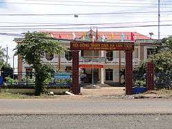 | |
 Bù Đốp District Location of Bù Đốp in Vietnam | |
| Coordinates: 12°15′N 107°35′E / 12.250°N 107.583°ECoordinates: 12°15′N 107°35′E / 12.250°N 107.583°E | |
| Country |
|
| Province | Bình Phước |
| Capital | Thanh Bình |
| Area | |
| • Total | 378 km2 (146 sq mi) |
| Population | |
| • Total | 51,597 |
Bù Đốp is a rural district in Bình Phước Province of the south-east region of Vietnam, approximately 90 km north of Ho Chi Minh City, near the border with Cambodia. As of 2003 the district had a population of 51,597.[1] The district covers an area of 378 km². The district capital lies at Thanh Bình.[1]
References
- 1 2 "Districts of Vietnam". Statoids. Retrieved March 20, 2009.
| District-level towns |
|  |
|---|---|---|
| Districts | ||
| Ho Chi Minh City | 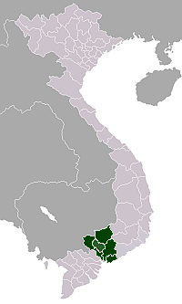 | |
|---|---|---|
| Bà Rịa-Vũng Tàu Province | ||
| Bình Dương Province |
| |
| Bình Phước Province |
| |
| Đồng Nai Province | ||
| Tây Ninh Province | ||
※ denotes provincial seat. | ||
This article is issued from
Wikipedia.
The text is licensed under Creative Commons - Attribution - Sharealike.
Additional terms may apply for the media files.