Tinoc, Ifugao
| Tinoc | ||
|---|---|---|
| Municipality | ||
| Municipality of Tinoc | ||
| ||
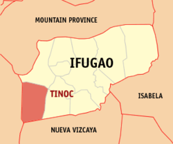 Map of Ifugao with Tinoc highlighted | ||
.svg.png) Tinoc Location within the Philippines | ||
| Coordinates: 16°42′N 120°54′E / 16.7°N 120.9°ECoordinates: 16°42′N 120°54′E / 16.7°N 120.9°E | ||
| Country |
| |
| Region | Cordillera Administrative Region (CAR) | |
| Province | Ifugao | |
| District | Lone District | |
| Barangays | 12 (see Barangays) | |
| Government [1] | ||
| • Type | Sangguniang Bayan | |
| • Mayor | Marcelo G. Catalino | |
| • Electorate | 8,495 voters (2016) | |
| Area [2] | ||
| • Total | 239.70 km2 (92.55 sq mi) | |
| Population (2015 census)[3] | ||
| • Total | 16,559 | |
| • Density | 69/km2 (180/sq mi) | |
| Time zone | UTC+8 (PST) | |
| ZIP code | 3609 | |
| PSGC | 142710000 | |
| IDD : area code | +63 (0)74 | |
| Climate | Cwb | |
| Income class | 4th municipal income class | |
| Revenue (₱) | 74,751,303.68 (2016) | |
| Native languages |
Ifugao language Kallahan language Tuwali language Tagalog | |
| Website |
www | |

Tinoc, officially the Municipality of Tinoc is a 4th class municipality in the province of Ifugao, Philippines. According to the 2015 census, it has a population of 16,559 people.[3]
Barangays
Tinoc is politically subdivided into 12 barangays. [2]
- Ahin
- Ap-apid
- Binablayan
- Danggo
- Eheb
- Gumhang
- Impugong
- Luhong
- Tinoc (Poblacion)
- Tukucan
- Tulludan
- Wangwang
Demographics
| Population census of Tinoc | ||
|---|---|---|
| Year | Pop. | ±% p.a. |
| 1990 | 8,256 | — |
| 1995 | 9,504 | +2.67% |
| 2000 | 9,783 | +0.62% |
| 2007 | 12,045 | +2.91% |
| 2010 | 14,147 | +6.03% |
| 2015 | 16,559 | +3.04% |
| Source: Philippine Statistics Authority[3][4][5][6] | ||
In the 2015 census, the population of Tinoc was 16,559 people,[3] with a density of 69 inhabitants per square kilometre or 180 inhabitants per square mile.
Religion
Evangelical and protestant churches have a strong presence with 48% adherence. There is a significant presence of catholic and animisim.
References
- ↑ "Municipality". Quezon City, Philippines: Department of the Interior and Local Government. Retrieved 31 May 2013.
- 1 2 "Province: Ifugao". PSGC Interactive. Quezon City, Philippines: Philippine Statistics Authority. Retrieved 12 November 2016.
- 1 2 3 4 Census of Population (2015). "Cordillera Administrative Region (CAR)". Total Population by Province, City, Municipality and Barangay. PSA. Retrieved 20 June 2016.
- ↑ Census of Population and Housing (2010). "Cordillera Administrative Region (CAR)". Total Population by Province, City, Municipality and Barangay. NSO. Retrieved 29 June 2016.
- ↑ Censuses of Population (1903–2007). "Cordillera Administrative Region (CAR)". Table 1. Population Enumerated in Various Censuses by Province/Highly Urbanized City: 1903 to 2007. NSO.
- ↑ "Province of Ifugao". Municipality Population Data. Local Water Utilities Administration Research Division. Retrieved 17 December 2016.
External links
- Philippine Standard Geographic Code
- Philippine Census Information
- Local Governance Performance Management System
Places adjacent to Tinoc, Ifugao | |
|---|---|
Lagawe (capital) | |
| Municipalities | |
| Barangays | |
This article is issued from
Wikipedia.
The text is licensed under Creative Commons - Attribution - Sharealike.
Additional terms may apply for the media files.