Kayapa
| Kayapa | ||
|---|---|---|
| Municipality | ||
| Municipality of Kayapa | ||
 | ||
| ||
|
Nickname(s): Gateway to the Cordilleras Summer Capital of Nueva Vizcaya | ||
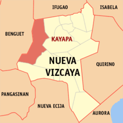 Map of Nueva Vizcaya with Kayapa highlighted | ||
.svg.png) Kayapa Location within the Philippines | ||
| Coordinates: 16°25′N 120°55′E / 16.42°N 120.92°ECoordinates: 16°25′N 120°55′E / 16.42°N 120.92°E | ||
| Country |
| |
| Region | Cagayan Valley (Region II) | |
| Province | Nueva Vizcaya | |
| District | Lone district | |
| Barangays | 30 (see Barangays) | |
| Government [1] | ||
| • Type | Sangguniang Bayan | |
| • Mayor | John D. Balasya | |
| • Electorate | 12,516 voters (2016) | |
| Area [2] | ||
| • Total | 482.90 km2 (186.45 sq mi) | |
| Population (2015 census)[3] | ||
| • Total | 23,714 | |
| • Density | 49/km2 (130/sq mi) | |
| Time zone | UTC+8 (PST) | |
| ZIP code | 3708 | |
| PSGC | 025010000 | |
| IDD : area code | +63 (0)78 | |
| Climate type | Tropical rainforest climate | |
| Income class | 3rd municipal income class | |
| Revenue (₱) | 114,520,473.25 (2016) | |
| Native languages |
Ilocano Gaddang Ibaloi I-Wak Kallahan language Karao | |

Kayapa, officially the Municipality of Kayapa, is a 3rd class municipality in the province of Nueva Vizcaya, Philippines. According to the 2015 census, it has a population of 23,714 people.[3]
Barangays
Kayapa is politically subdivided into 30 barangays.
- Acacia
- Amelong Labeng
- Ansipsip
- Baan
- Babadi
- Balangabang
- Banao
- Binalian
- Besong
- Cabalatan-Alang
- Cabanglasan
- Kayapa Proper East
- Kayapa Proper West
- Mapayao
- Nansiakan
- Pampang (Poblacion)
- Pangawan
- Pinayag
- Pingkian
- San Fabian
- Talecabcab
- Tubongan
- Alang-Salacsac
- Balete
- Buyasyas
- Cabayo
- Castillo Village
- Latbang
- Lawigan
- Tidang Village
Demographics
| Population census of Kayapa | ||
|---|---|---|
| Year | Pop. | ±% p.a. |
| 1918 | 7,577 | — |
| 1939 | 8,702 | +0.66% |
| 1948 | 5,759 | −4.48% |
| 1960 | 9,298 | +4.07% |
| 1970 | 14,920 | +4.84% |
| 1975 | 20,718 | +6.81% |
| 1980 | 20,491 | −0.22% |
| 1990 | 18,685 | −0.92% |
| 1995 | 19,376 | +0.68% |
| 2000 | 19,193 | −0.20% |
| 2007 | 20,806 | +1.12% |
| 2010 | 21,453 | +1.12% |
| 2015 | 23,714 | +1.93% |
| Source: Philippine Statistics Authority[3][4][5][6] | ||
Gallery
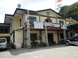 Municipal hall
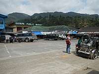 Public market
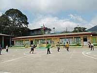 Kayapa Central School
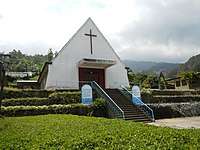 Saint Joseph Parish Church
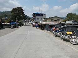
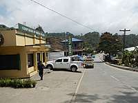 Town proper
References
- ↑ "Municipality". Quezon City, Philippines: Department of the Interior and Local Government. Retrieved 31 May 2013.
- ↑ "Province: Nueva Vizcaya". PSGC Interactive. Quezon City, Philippines: Philippine Statistics Authority. Retrieved 12 November 2016.
- 1 2 3 Census of Population (2015). "Region II (Cagayan Valley)". Total Population by Province, City, Municipality and Barangay. PSA. Retrieved 20 June 2016.
- ↑ Census of Population and Housing (2010). "Region II (Cagayan Valley)". Total Population by Province, City, Municipality and Barangay. NSO. Retrieved 29 June 2016.
- ↑ Censuses of Population (1903–2007). "Region II (Cagayan Valley)". Table 1. Population Enumerated in Various Censuses by Province/Highly Urbanized City: 1903 to 2007. NSO.
- ↑ "Province of Nueva Vizcaya". Municipality Population Data. Local Water Utilities Administration Research Division. Retrieved 17 December 2016.
External links

- Philippine Standard Geographic Code
- Philippine Census Information
- Local Governance Performance Management System
Places adjacent to Kayapa | |
|---|---|
Bayombong (capital) | |
| Municipalities | |
| Barangays | |
This article is issued from
Wikipedia.
The text is licensed under Creative Commons - Attribution - Sharealike.
Additional terms may apply for the media files.