Mayoyao, Ifugao
| Mayoyao | ||
|---|---|---|
| Municipality | ||
| Municipality of Mayoyao | ||
| ||
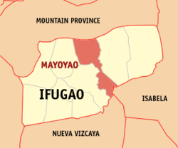 Map of Ifugao with Mayoyao highlighted | ||
.svg.png) Mayoyao Location within the Philippines | ||
| Coordinates: 16°58′N 121°13′E / 16.97°N 121.22°ECoordinates: 16°58′N 121°13′E / 16.97°N 121.22°E | ||
| Country |
| |
| Region | Cordillera Administrative Region (CAR) | |
| Province | Ifugao | |
| District | Lone District | |
| Barangays | 27 (see Barangays) | |
| Government [1] | ||
| • Type | Sangguniang Bayan | |
| • Mayor | Ronie H. Lumayna | |
| • Electorate | 7,197 voters (2016) | |
| Area [2] | ||
| • Total | 238.05 km2 (91.91 sq mi) | |
| Population (2015 census)[3] | ||
| • Total | 17,331 | |
| • Density | 73/km2 (190/sq mi) | |
| Time zone | UTC+8 (PST) | |
| ZIP code | 3602 | |
| PSGC | 142706000 | |
| IDD : area code | +63 (0)74 | |
| Climate | Am | |
| Income class | 4th municipal income class | |
| Revenue (₱) | 79,599,407.61 (2016) | |
| Native languages |
Ifugao language Tuwali language Tagalog | |

Mayoyao, officially the Municipality of Mayoyao is a 4th class municipality in the province of Ifugao, Philippines. According to the 2015 census, it has a population of 17,331 people.[3]
Barangays
Mayoyao is politically subdivided into 27 barangays. [2]
- Aduyongan
- Alimit
- Ayangan
- Balangbang
- Banao
- Banhal
- Bongan
- Buninan
- Chaya
- Chumang
- Guinihon
- Inwaloy
- Langayan
- Liwo
- Maga
- Magulon
- Mapawoy
- Mayoyao Proper
- Mongol
- Nalbu
- Nattum
- Palaad
- Poblacion
- Talboc
- Tulaed
- Bato-Alatbang
- Epeng
History
Battle of Mayoyao Ridge
| Battle of Mayoyao Ridge | |||||||
|---|---|---|---|---|---|---|---|
| Part of World War II | |||||||
| |||||||
| Belligerents | |||||||
|
| |||||||
| Commanders and leaders | |||||||
|
|
| ||||||
| Strength | |||||||
|
68,000 Filipino troops 200 American bomber pilots | 85,000 Japanese troops | ||||||
| Casualties and losses | |||||||
|
4,600 killed 7,200 wounded |
51,000 killed 3,000 wounded | ||||||
From July 26, to August 9, 1945, Filipino soldiers under the command of Donald Blackburn, supported by airstrikes by Army Air Forces, captured the Japanese stronghold of Mayoyao, Ifugao in Northern Luzon.[4]:305–320 This included the Filipino troops of the 1st, 2nd, 11th, 12th, 13th, 15th and 16th Infantry Division of the Philippine Commonwealth Army, 1st Infantry Regiment of the Philippine Constabulary, 11th and 14th Infantry Regiment of the United States Armed Forces in the Philippines - Northern Luzon or USAFIP-NL and the American bomber pilots of the United States Army Air Forces was fought against the Japanese Imperial forces during the Battle of Mayoyao Ridge until the end of World War II.
Historical marker
The memorial or historical marker, located at Mount Nagchajan in Mayoyao, Ifugao, marks the site of the “Battle of Mayoyao Ridge”. The battle was fought between the Japanese Imperial forces and the combined Filipino and American soldiers, towards the end of World War II. The result was key to the eventual surrender of General Yamashita at Kiangan, Ifugao.
Demographics
| Population census of Mayoyao | ||
|---|---|---|
| Year | Pop. | ±% p.a. |
| 1918 | 10,226 | — |
| 1939 | 9,184 | −0.51% |
| 1948 | 8,093 | −1.40% |
| 1960 | 15,028 | +5.29% |
| 1970 | 20,189 | +2.99% |
| 1975 | 24,422 | +3.89% |
| 1980 | 24,022 | −0.33% |
| 1990 | 23,942 | −0.03% |
| 1995 | 14,733 | −8.70% |
| 2000 | 14,191 | −0.80% |
| 2007 | 16,722 | +2.29% |
| 2010 | 16,413 | −0.68% |
| 2015 | 17,331 | +1.04% |
| Source: Philippine Statistics Authority[3][5][6][7] | ||
In the 2015 census, the population of Mayoyao was 17,331 people,[3] with a density of 73 inhabitants per square kilometre or 190 inhabitants per square mile.
References
- ↑ "Municipality". Quezon City, Philippines: Department of the Interior and Local Government. Retrieved 31 May 2013.
- 1 2 "Province: Ifugao". PSGC Interactive. Quezon City, Philippines: Philippine Statistics Authority. Retrieved 12 November 2016.
- 1 2 3 4 Census of Population (2015). "Cordillera Administrative Region (CAR)". Total Population by Province, City, Municipality and Barangay. PSA. Retrieved 20 June 2016.
- ↑ Harkins, P., 1956, Blackburn's Headhunters, London: Cassell & Co. LTD
- ↑ Census of Population and Housing (2010). "Cordillera Administrative Region (CAR)". Total Population by Province, City, Municipality and Barangay. NSO. Retrieved 29 June 2016.
- ↑ Censuses of Population (1903–2007). "Cordillera Administrative Region (CAR)". Table 1. Population Enumerated in Various Censuses by Province/Highly Urbanized City: 1903 to 2007. NSO.
- ↑ "Province of Ifugao". Municipality Population Data. Local Water Utilities Administration Research Division. Retrieved 17 December 2016.
External links
- Mayoyao Rice Terraces
- Philippine Standard Geographic Code
- Philippine Census Information
- Local Governance Performance Management System
- Heritage Town: Mayoyao, Ifugao
- Chasing Waterfalls: Tenogtog Falls
- Chasing Waterfalls: Manhencha Falls
Places adjacent to Mayoyao, Ifugao | |
|---|---|