Hingyon, Ifugao
| Hingyon | |
|---|---|
| Municipality | |
| Municipality of Hingyon | |
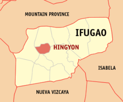 Map of Ifugao with Hingyon highlighted | |
.svg.png) Hingyon Location within the Philippines | |
| Coordinates: 16°50′N 121°07′E / 16.83°N 121.12°ECoordinates: 16°50′N 121°07′E / 16.83°N 121.12°E | |
| Country |
|
| Region | Cordillera Administrative Region (CAR) |
| Province | Ifugao |
| District | Lone District |
| Barangays | 12 (see Barangays) |
| Government [1] | |
| • Type | Sangguniang Bayan |
| • Mayor | Geraldo D. Luglug |
| • Electorate | 7,787 voters (2016) |
| Area [2] | |
| • Total | 62.02 km2 (23.95 sq mi) |
| Population (2015 census)[3] | |
| • Total | 9,227 |
| • Density | 150/km2 (390/sq mi) |
| Time zone | UTC+8 (PST) |
| ZIP code | 3607 |
| PSGC | 142709000 |
| IDD : area code | +63 (0)74 |
| Climate type | Tropical rainforest climate |
| Income class | 5th municipal income class |
| Revenue (₱) | 46,708,751.64 (2016) |
| Native languages |
Ifugao language Tuwali language Tagalog |
Hingyon, officially the Municipality of Hingyon is a 5th class municipality in the province of Ifugao, Philippines. According to the 2015 census, it has a population of 9,227 people.[3]
Barangays
Hingyon is politically subdivided into 12 barangays. [2]
- Anao
- Bangtinon
- Bitu
- Southern Cababuyan
- Mompolia
- Namulditan
- O-ong
- Piwong
- Poblacion (Hingyon)
- Ubuag
- Umalbong
- Northern Cababuyan
Demographics
| Population census of Hingyon | ||
|---|---|---|
| Year | Pop. | ±% p.a. |
| 1990 | 8,373 | — |
| 1995 | 9,724 | +2.84% |
| 2000 | 9,769 | +0.10% |
| 2007 | 10,071 | +0.42% |
| 2010 | 9,795 | −1.01% |
| 2015 | 9,227 | −1.13% |
| Source: Philippine Statistics Authority[3][4][5][6] | ||
In the 2015 census, the population of Hingyon was 9,227 people,[3] with a density of 150 inhabitants per square kilometre or 390 inhabitants per square mile.
References
- ↑ "Municipality". Quezon City, Philippines: Department of the Interior and Local Government. Retrieved 31 May 2013.
- 1 2 "Province: Ifugao". PSGC Interactive. Quezon City, Philippines: Philippine Statistics Authority. Retrieved 12 November 2016.
- 1 2 3 4 Census of Population (2015). "Cordillera Administrative Region (CAR)". Total Population by Province, City, Municipality and Barangay. PSA. Retrieved 20 June 2016.
- ↑ Census of Population and Housing (2010). "Cordillera Administrative Region (CAR)". Total Population by Province, City, Municipality and Barangay. NSO. Retrieved 29 June 2016.
- ↑ Censuses of Population (1903–2007). "Cordillera Administrative Region (CAR)". Table 1. Population Enumerated in Various Censuses by Province/Highly Urbanized City: 1903 to 2007. NSO.
- ↑ "Province of Ifugao". Municipality Population Data. Local Water Utilities Administration Research Division. Retrieved 17 December 2016.
External links
- More photos and information on Hingyon, Ifugao
- Philippine Standard Geographic Code
- Philippine Census Information
- Local Governance Performance Management System
Lagawe (capital) | |
| Municipalities | |
| Barangays | |
This article is issued from
Wikipedia.
The text is licensed under Creative Commons - Attribution - Sharealike.
Additional terms may apply for the media files.