Thirumanimutharu River (tributary of Kaveri)
| Thirumanimutharu river | |
|---|---|
| Native name | திருமணிமுத்தாறு |
| Country |
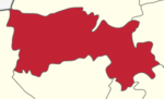
Salem District, Namakkal district India |
| Physical characteristics | |
| Main source |
Manjavadi , Shevaroy Mountain at Yercaud 1,515 meters (4,970 ft) 11°46′45″N 78°12′12″E / 11.77917°N 78.20333°E |
| River mouth |
Nanjai Edayar at Namakkal district 121 meters (397 ft) 11°05′58″N 78°02′04″E / 11.09944°N 78.03444°ECoordinates: 11°05′58″N 78°02′04″E / 11.09944°N 78.03444°E |
| Length | 120 kilometers (75 mi) |
The Thirumanimutharu River is origin form Manjavadi in Shevaroy Mountain and through the Salem and Namakkal districts of the Indian state of Tamil Nadu. It rises in the Yercaud hills.[1] Thirumanimutharu River joins the Cauvery at Nanjai Edayar place in Namakkal.
Places on The Thirumanimutharu river bank
Manjavadi, Yercaud hills, Salem City, Vennandur, Nanjai Edayar.
References
- ↑ "Thirumanimutharu River". Archived from the original on 2011-09-28.
See also
This article is issued from
Wikipedia.
The text is licensed under Creative Commons - Attribution - Sharealike.
Additional terms may apply for the media files.