Omalur
| Omalur ஓமலூர் | |
|---|---|
| Town | |
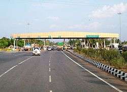 NH7 Omalur Tollplaza near Salem | |
 Omalur | |
| Coordinates: 11°44′42″N 78°02′49″E / 11.745°N 78.047°ECoordinates: 11°44′42″N 78°02′49″E / 11.745°N 78.047°E | |
| Country | India |
| State | Tamil Nadu |
| District | Salem |
| Government | |
| • Member of Legislative Assembly | vetrivel |
| Area | |
| • Total | 8.16 km2 (3.15 sq mi) |
| Elevation | 298 m (978 ft) |
| Population (2011) | |
| • Total | 16,279[1] |
| Languages | |
| • Official | Tamil |
| Time zone | UTC+5:30 (IST) |
| PIN | 636455 |
| Telephone code | 04290 |
| Vehicle registration | TN-30 |
Omalur (Tamil:ஓமலூர்) is a panchayat town in the Salem District in the Indian state of Tamil Nadu. It is situated on the National Highway 7 between 11° 73333" latitude and 78° 06667" longitude. It has a population of about 13,600. Agriculture, leather and handloom textiles are the major business. It is the second largest taluk in the district of Salem. Omalur has 95 census villages.
History
In 14th century, Omalur Kottai built.
The Madurai Nayaks ruled Kongu Nadu, the Gatti Mudalis were the made in-charge of Omalur, Taramangalam and others. They built the temple at Taramangalam which is an architectural wonder. The Salem district, the most dangerously exposed province of the Madurai Nayaks rule. They ruled from Taramangalam, where they built a costly temple. In Salem district, they held the important strategic fort of Omalur and Attur.
The Gatti Mudalis's rule extended east-west from Thalaivasal to Dharapuram and north-south from Omalur to Karur. After the fall of the Vijayanagara Empire, the Gatti Mudalis became the Palaiyakkarar of Omalur under Tirumalai Nayak of Madurai in 1623.
In 1660, Chikka Deveraja conquered Sankagiri, Thoppur and Omalur. In 1667, the Gatti Mudalis lost Omalur to Mysore. In 1688-89, Chikka Deva Raya, the king of Mysore, felt strong enough once again to invade Baramahal and the whole district of Salem came under his control before his death in 1704.
In 1815 Omalur taluk was absorbed into Salem taluk, but was recreated in 1819. It was again absorbed by Salem taluk in 1860, and again recreated in 1910. In 1916 Omalur taluk bifurcated into Omalur and Mettur, and in 1941 Mettur Taluk was absorbed into Omalur.
Omalur near 2km at SALEM AIRPORT. Now growing and developing area in salem district.. main area for mettur and dharmapuri and banglore and tirupathi
TEMPLES OF OMALUR TOWN:
- Kasi Vishvanadhar temple, sevvai sandhai, omalur
- kottai marriamman temple, omalur town
- Vasandheeshwarar temple, omalur fort
- Vijayaragawar perumal temple, Omalur fort
- Sri Ramalinga Sowdeswari Amman
Geography
Omalur is located at 11°44′N 78°04′E / 11.73°N 78.07°E.[2] It has an average elevation of 298 metres (977 feet).
Demographics
As of 2011 India census, Omalur had a population of 16,279. Males constitute 49.3% of the population and females 50.7%. Omalur has an average literacy rate of 84.82%, higher than the state average of 80.09%: male literacy is 90.3%, and female literacy is 79.53%. In Omalur, 9.8% of the population is under 6 years of age. 88.13% of population are Hindus, 9.66% are Muslims and 2.16% are Christians.
Climate
The climate is generally hot and dry. Summer stretches from February to July with its peak during the months of April and May. Temperatures stay above 30 °C and can reach 37 °C. During this time it gets occasional spells of rain. During the months of August and September the South-West monsoons start and bring about 100 mm of rain. In October and November it receives the North-East monsoon.
Education
Schools
- Vellasami Chettiyar Higher Secondary School, Omalur
- Fatima Girls Higher Secondary School, Omalur
- Kalaimagal matriculation higher secondary school, RC Chettipatti, Omalur
- SSRM Higher secondary school, karrupur.
- Mount Shervaroys Matriculation School, Poosarippatti
- Government Higher Secondary School, Nadupatti
- South Indian Matriculation & Higher Secondary School, Panchukalipatti
- Swamy Vivekanatha Matriculation School, Kadayampatti
- G. R. Matriculation School, Muthunaickenpatti.
- Wistom Gates Matriculation School, Kottaimariammankoil
- St. Joseph Matriculation School, Pagalpatti
- John Britto Matriculation School, Kamalapuram
- Govt Higher secondary school, Periyapatty, semmandapatty village
- Govt Higher secondary school, Pannapatty
- Govt Higher secondary school, muthu Naikken Patty
- Govt Higher secondary school, Vellalappatti
- Govt Higher secondary school, Mattukkaranur
- Panchayat Union Primary School, Kamalapur
Colleges and Universities
- Government Engineering College salem-11, Salem (Autonomous)(Anna University, Chennai)
- Periyar University at Omalur town 3 km. Omalur (TK)
- Dhirajlal gandhi college of technology, Opp. Salem Airport, Sikanampatty, Omalur, Salem.Affiliated to ANNA UNIVERSITY, CHENNAI.
- Narusu's Sarathy Institute of Technology, Poosaripatti at Omalur town 6 km. Omalur (TK)Affiliated to ANNA UNIVERSITY, CHENNAI.
- Padmavani Arts & Science College (near Periyar University) at Omalur town 3 km. Omalur (TK)
- Balakrishna Polytechnic College at Omalur town 4 km. Omalur (TK)
- DPC Polytechnic College at Omalur town 6 km. Omalur (TK)
- Padmavani Arts & Science College for Women
- Kevi Women’s College of Education
- Dhanam College of Education
- Sri Balakrishna Polytechnic College
- Sri Balamurugan Arts and Science College
Villages and its population[3]
- Desavilakku - 19188
- Kanjanayakanpatti - 15611
- Muthunaickenpatti - 13192
- Thumbipadi - 12515
- Kamalapuram - 11364
- Kongupatti - 10400
- Pappambadi - 10284
- Danishpet - 9618
- Arurpatti - 9228
- Pachanampatti - 8211
- Kanavoipudur - 8010
- Pagalpatti - 7834
- Omalur - 7756
- Thekkampatti - 7679
- Semmandapatti - 7618
- Chellapillaikuttai - 7534
- Ramireddipatti - 7246
- Manathal - 7232
- Pannapatti - 7159
- Vellalapatti - 6833
- Marakkottai - 6736
- Gundikkal - 6676
- T.Konagapadi - 6489
- Selavadi - 6400
- Amarakundhi - 6100
- Pottipuram - 6070
- Kodunaickenpatty pudur - 5929
- Deevattipatti - 5821
- Naduppatti - 5652
- Darapuram - 5539
- Kadayampatti - 5292
- Kottamettupatti - 5042
- Veppilai - 5031
- Tholasampatti - 4858
- Chikkampatti - 4666
- Kookuttapatti - 4546
- M.Chettipati - 4350
- Poosaripatti - 4146
- Saminayakkanpatti - 4142
- Panjakalipatti - 3953
- Mungilpadi - 3946
- Mookanur - 3754
- Tindamangalam - 3670
- Sikkanampatti - 3638
- Thathayangarpatti - 3413
- T.Maramangalam - 3333
- Sakkarachettipatti - 3301
- Umbilikamaramangalam - 3280
- Kullamanickenpatti - 3274
- Alagusamudram - 3264
- Mallikuttai - 3252
- Puliyampatti - 3243
- Periyerippatti - 3197
- Ellavampatti - 3155
- Karuppanampatti - 2711
- Balbakki - 2705
- Sangitapatti - 2589
- Thathayampatti - 2577
- Ariyampatti - 2577
- Dasasamudram - 2366
- Elathur - 2337
- Sekkarapatti - 2319
- Ettikuttapatti - 2280
- Idaiyapatti - 2166
- Collappatti - 2124
- Thondamaniyam - 1653
- Manguppai - 1556
- Sekkarapatti - 1434
- Jagadevampatti - 1379
- Reddipatti - 1218
- Vedapatti - 1137
- Gobinathapuram - 1107
- Panikkanur - 989
- Kaniyeri R.F. - 964
- Mailapalaiyam - 908
- Naranampalayam - 893
- Kattaperiyampatti - 869
- Palappallikombai - 807
- Kaminaickanpatti - 637
- Lokkur R.F. - 111
Politics
Omalur assembly constituency is part of Salem (Lok Sabha constituency).[4]
References
- ↑ http://www.census2011.co.in/data/town/803452-omalur.html
- ↑ Falling Rain Genomics, Inc - Omalur
- ↑ http://www.census2011.co.in/data/subdistrict/5737-omalur-salem-tamil-nadu.html
- ↑ "List of Parliamentary and Assembly Constituencies" (PDF). Tamil Nadu. Election Commission of India. Archived from the original (PDF) on 2009-02-06.