Tayug, Pangasinan
| Tayug | ||
|---|---|---|
| Municipality | ||
| Municipality of Tayug | ||
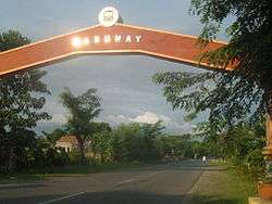 Tayug Welcome Arch | ||
| ||
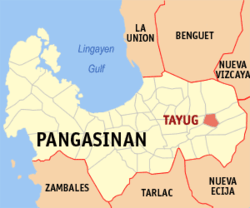 Map of Pangasinan with Tayug highlighted | ||
.svg.png) Tayug Location within the Philippines | ||
| Coordinates: 16°01′36″N 120°44′52″E / 16.02667°N 120.74778°ECoordinates: 16°01′36″N 120°44′52″E / 16.02667°N 120.74778°E | ||
| Country |
| |
| Region | Ilocos Region (Region I) | |
| Province | Pangasinan | |
| District | 6th district of Pangasinan | |
| Founded | March 17, 1817 | |
| Barangays | 21 (see Barangays) | |
| Government [1] | ||
| • Type | Sangguniang Bayan | |
| • Mayor | Tyrone Damasen Agabas | |
| • Vice Mayor | Carlos Trece Mapili | |
| • Electorate | 25,600 voters (2016) | |
| Area [2] | ||
| • Total | 51.24 km2 (19.78 sq mi) | |
| Population (2015 census)[3] | ||
| • Total | 43,149 | |
| • Density | 840/km2 (2,200/sq mi) | |
| Time zone | UTC+8 (PST) | |
| ZIP code | 2445 | |
| PSGC | 015543000 | |
| IDD : area code | +63 (0)75 | |
| Climate type | Tropical monsoon climate | |
| Income class | 3rd municipal income class | |
| Revenue (₱) | 114,844,832.61 (2016)[4] | |
| Poverty incidence | 6.71 (2012)[5] | |
| Native languages |
Pangasinan Ilocano Tagalog | |

Tayug, officially the Municipality of Tayug, (Pangasinan: Baley na Tayug; Ilokano: Ili ti Tayug; Tagalog: Bayan ng Tayug), is a 3rd class municipality in the province of Pangasinan, Philippines. According to the 2015 census, it has a population of 43,149 people.[3]
The town of Tayug got its unique name not from people who were influential or from name of saints but from a very tall tree that once grew in the heart of the town; the bacayao tree was so tall that in Ilocano they call it “Layug”. In view of the difficulty of the people to pronounce the letter “L” they change it to letter “T” by common usage. Hence, the name Tayug came about.
Barangays
Tayug is politically subdivided into 21 barangays.
- Agno
- Amistad
- Barangobong
- Carriedo
- C. Lichauco
- Evangelista
- Guzon
- Lawak
- Legaspi
- Libertad
- Magallanes
- Panganiban
- Barangay Poblacion A
- Barangay Poblacion B
- Barangay Poblacion C
- Barangay Poblacion D
- Saleng
- Santo Domingo
- Toketec
- Trenchera
- Zamora
Climate
| Climate data for Tayug, Pangasinan | |||||||||||||
|---|---|---|---|---|---|---|---|---|---|---|---|---|---|
| Month | Jan | Feb | Mar | Apr | May | Jun | Jul | Aug | Sep | Oct | Nov | Dec | Year |
| Average high °C (°F) | 31 (88) |
31 (88) |
32 (90) |
34 (93) |
35 (95) |
34 (93) |
32 (90) |
32 (90) |
32 (90) |
32 (90) |
32 (90) |
31 (88) |
32 (90) |
| Average low °C (°F) | 22 (72) |
22 (72) |
22 (72) |
24 (75) |
24 (75) |
24 (75) |
24 (75) |
24 (75) |
24 (75) |
23 (73) |
23 (73) |
22 (72) |
23 (74) |
| Average precipitation mm (inches) | 13.6 (0.535) |
10.4 (0.409) |
18.2 (0.717) |
15.7 (0.618) |
178.4 (7.024) |
227.9 (8.972) |
368 (14.49) |
306.6 (12.071) |
310.6 (12.228) |
215.7 (8.492) |
70.3 (2.768) |
31.1 (1.224) |
1,766.5 (69.548) |
| Average rainy days | 3 | 2 | 2 | 4 | 14 | 16 | 23 | 21 | 24 | 15 | 10 | 6 | 140 |
| Source: World Weather Online[6] | |||||||||||||
Demographics
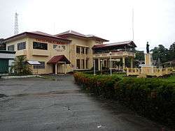
Tayug town hall and library
| Population census of Tayug | ||
|---|---|---|
| Year | Pop. | ±% p.a. |
| 1903 | 10,400 | — |
| 1918 | 13,594 | +1.80% |
| 1939 | 16,222 | +0.85% |
| 1948 | 19,782 | +2.23% |
| 1960 | 20,755 | +0.40% |
| 1970 | 24,143 | +1.52% |
| 1975 | 26,153 | +1.62% |
| 1980 | 26,273 | +0.09% |
| 1990 | 31,575 | +1.86% |
| 1995 | 33,881 | +1.33% |
| 2000 | 36,199 | +1.43% |
| 2007 | 37,954 | +0.66% |
| 2010 | 40,018 | +1.95% |
| 2015 | 43,149 | +1.44% |
| Source: Philippine Statistics Authority[3][7][8][9] | ||
References
- ↑ "Municipality". Quezon City, Philippines: Department of the Interior and Local Government. Retrieved 31 May 2013.
- ↑ "Province: Pangasinan". PSGC Interactive. Quezon City, Philippines: Philippine Statistics Authority. Retrieved 12 November 2016.
- 1 2 3 Census of Population (2015). "Region I (Ilocos Region)". Total Population by Province, City, Municipality and Barangay. PSA. Retrieved 20 June 2016.
- ↑ "Pangasinan : Cities and Municipalities Competitiveness Index". Makati City, Philippines: National Competitiveness Council (Philippines). Archived from the original on 28 January 2017. Retrieved 28 January 2017.
- ↑ "PSA Releases the 2012 Municipal and City Level Poverty Estimates". Quezon City, Philippines: Philippine Statistics Authority. Archived from the original on 28 January 2017. Retrieved 28 January 2017.
- ↑ "Tayug, Pangasinan: Average Temperatures and Rainfall". World Weather Online. Retrieved 31 October 2015.
- ↑ Census of Population and Housing (2010). "Region I (Ilocos Region)". Total Population by Province, City, Municipality and Barangay. NSO. Retrieved 29 June 2016.
- ↑ Censuses of Population (1903–2007). "Region I (Ilocos Region)". Table 1. Population Enumerated in Various Censuses by Province/Highly Urbanized City: 1903 to 2007. NSO.
- ↑ "Province of Pangasinan". Municipality Population Data. Local Water Utilities Administration Research Division. Retrieved 17 December 2016.
External links
| Wikimedia Commons has media related to Tayug, Pangasinan. |
- Municipal Profile at the National Competitiveness Council of the Philippines
- Bolinao at the Pangasinan Government Website
- Local Governance Performance Management System
- Philippine Standard Geographic Code
- Philippine Census Information
- Pangasinan.org : Tayug Family and School Reunion Archives
- tayug.net.ph
Places adjacent to Tayug, Pangasinan | |
|---|---|
Lingayen (capital) | |
| Municipalities |
|
| Component cities | |
| Independent component city |
|
| Barangays | |
This article is issued from
Wikipedia.
The text is licensed under Creative Commons - Attribution - Sharealike.
Additional terms may apply for the media files.