Infanta, Pangasinan
| Infanta | ||
|---|---|---|
| Municipality | ||
| Municipality of Infanta | ||
 | ||
| ||
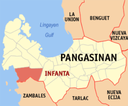 Map of Pangasinan with Infanta highlighted | ||
.svg.png) Infanta Location within the Philippines | ||
| Coordinates: 15°49′15″N 119°54′30″E / 15.82083°N 119.90833°ECoordinates: 15°49′15″N 119°54′30″E / 15.82083°N 119.90833°E | ||
| Country |
| |
| Region | Ilocos Region (Region I) | |
| Province | Pangasinan | |
| District | 1st district of Pangasinan | |
| Founded | October 4, 1876 | |
| Barangays | 13 (see Barangays) | |
| Government [1] | ||
| • Type | Sangguniang Bayan | |
| • Mayor | Percival A. Mallare | |
| • Electorate | 15,287 voters (2016) | |
| Area [2] | ||
| • Total | 254.29 km2 (98.18 sq mi) | |
| Population (2015 census)[3] | ||
| • Total | 24,584 | |
| • Density | 97/km2 (250/sq mi) | |
| Time zone | UTC+8 (PST) | |
| ZIP code | 2412 | |
| PSGC | 015520000 | |
| IDD : area code | +63 (0)75 | |
| Climate type | Tropical monsoon climate | |
| Income class | 3rd municipal income class | |
| Revenue (₱) | 98,392,489.45 (2016) [4] | |
| Poverty incidence | 9.50 (2012)[5] | |
| Native languages |
Pangasinan Sambal Ilocano Tagalog | |
| Website |
infantapangasinan | |

Infanta, officially the Municipality of Infanta, (Pangasinan: Baley na Infanta; Ilokano: Ili ti Infanta; Tagalog: Bayan ng Infanta), is a 3rd class municipality in the province of Pangasinan, Philippines. According to the 2015 census, it has a population of 24,584 people.[3]
Barangays
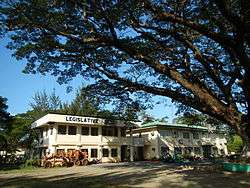
Infanta Town Hall
Infanta is politically subdivided into 13 barangays.
- Bamban
- Batang
- Bayambang
- Cato
- Doliman
- Patima
- Maya
- Nangalisan
- Nayom
- Pita
- Poblacion
- Potol
- Babuyan
Demographics
| Population census of Infanta | ||
|---|---|---|
| Year | Pop. | ±% p.a. |
| 1903 | 3,546 | — |
| 1918 | 5,613 | +3.11% |
| 1939 | 5,453 | −0.14% |
| 1948 | 5,379 | −0.15% |
| 1960 | 7,582 | +2.90% |
| 1970 | 10,469 | +3.28% |
| 1975 | 11,336 | +1.61% |
| 1980 | 12,323 | +1.68% |
| 1990 | 16,149 | +2.74% |
| 1995 | 18,839 | +2.93% |
| 2000 | 20,632 | +1.97% |
| 2007 | 23,731 | +1.95% |
| 2010 | 23,455 | −0.42% |
| 2015 | 24,584 | +0.90% |
| Source: Philippine Statistics Authority[3][6][7][8] | ||
Climate
| Climate data for Infanta, Pangasinan | |||||||||||||
|---|---|---|---|---|---|---|---|---|---|---|---|---|---|
| Month | Jan | Feb | Mar | Apr | May | Jun | Jul | Aug | Sep | Oct | Nov | Dec | Year |
| Average high °C (°F) | 31 (88) |
31 (88) |
31 (88) |
33 (91) |
32 (90) |
32 (90) |
30 (86) |
30 (86) |
30 (86) |
31 (88) |
31 (88) |
31 (88) |
31 (88) |
| Average low °C (°F) | 21 (70) |
21 (70) |
22 (72) |
24 (75) |
24 (75) |
24 (75) |
23 (73) |
23 (73) |
23 (73) |
23 (73) |
23 (73) |
22 (72) |
23 (73) |
| Average precipitation mm (inches) | 5.1 (0.201) |
11.6 (0.457) |
21.1 (0.831) |
27.7 (1.091) |
232.9 (9.169) |
350.8 (13.811) |
679.8 (26.764) |
733.1 (28.862) |
505 (19.88) |
176.6 (6.953) |
67.2 (2.646) |
17.7 (0.697) |
2,828.6 (111.362) |
| Average rainy days | 3 | 3 | 3 | 4 | 14 | 18 | 23 | 25 | 22 | 15 | 8 | 4 | 142 |
| Source: World Weather Online[9] | |||||||||||||
References
- ↑ "Municipality". Quezon City, Philippines: Department of the Interior and Local Government. Retrieved 31 May 2013.
- ↑ "Province: Pangasinan". PSGC Interactive. Quezon City, Philippines: Philippine Statistics Authority. Retrieved 12 November 2016.
- 1 2 3 Census of Population (2015). "Region I (Ilocos Region)". Total Population by Province, City, Municipality and Barangay. PSA. Retrieved 20 June 2016.
- ↑ "Pangasinan : Cities and Municipalities Competitiveness Index". Makati City, Philippines: National Competitiveness Council (Philippines). Archived from the original on 28 January 2017. Retrieved 28 January 2017.
- ↑ "PSA Releases the 2012 Municipal and City Level Poverty Estimates". Quezon City, Philippines: Philippine Statistics Authority. Retrieved 28 January 2017.
- ↑ Census of Population and Housing (2010). "Region I (Ilocos Region)". Total Population by Province, City, Municipality and Barangay. NSO. Retrieved 29 June 2016.
- ↑ Censuses of Population (1903–2007). "Region I (Ilocos Region)". Table 1. Population Enumerated in Various Censuses by Province/Highly Urbanized City: 1903 to 2007. NSO.
- ↑ "Province of Pangasinan". Municipality Population Data. Local Water Utilities Administration Research Division. Retrieved 17 December 2016.
- ↑ "Infanta, Pangasinan: Average Temperatures and Rainfall". World Weather Online. Retrieved 26 September 2015.
External links
| Wikimedia Commons has media related to Infanta, Pangasinan. |
- Municipal Profile at the National Competitiveness Council of the Philippines
- Infanta at the Pangasinan Government Website
- Local Governance Performance Management System
- Philippine Standard Geographic Code
- Philippine Census Information
- Pangasinan.org : Infanta Family and School Reunion Archives
Places adjacent to Infanta, Pangasinan | ||||||||||
|---|---|---|---|---|---|---|---|---|---|---|
| ||||||||||
Lingayen (capital) | |
| Municipalities |
|
| Component cities | |
| Independent component city |
|
| Barangays | |
This article is issued from
Wikipedia.
The text is licensed under Creative Commons - Attribution - Sharealike.
Additional terms may apply for the media files.