Taino, Lombardy
| Taino | |
|---|---|
| Comune | |
| Comune di Taino | |
.svg.png) | |
 Taino Location of Taino in Italy | |
| Coordinates: 45°46′N 8°37′E / 45.767°N 8.617°ECoordinates: 45°46′N 8°37′E / 45.767°N 8.617°E | |
| Country | Italy |
| Region | Lombardy |
| Province | Province of Varese (VA) |
| Frazioni | Cheglio |
| Government | |
| • Mayor | Marco Mira Catò |
| Area | |
| • Total | 7.7 km2 (3.0 sq mi) |
| Elevation | 262 m (860 ft) |
| Population (Dec. 2004) | |
| • Total | 3,353 |
| • Density | 440/km2 (1,100/sq mi) |
| Demonym(s) | Tainesi (dumìt in local dialect) |
| Time zone | UTC+1 (CET) |
| • Summer (DST) | UTC+2 (CEST) |
| Postal code | 21020 |
| Dialing code | 0331 |
| Website | Official website |
Taino (Italian pronunciation: [taˈiːno]) is a comune (municipality) in the Province of Varese in the Italian region Lombardy, located about 50 km northwest of Milan and about 20 km southwest of Varese. As of 31 December 2004, it had a population of 3,353 and an area of 7.7 km².[1]
The municipality of Taino contains the frazione (subdivision) Cheglio (pronounced [ˈkeʎʎo]).
Taino borders the following municipalities: Angera, Sesto Calende.
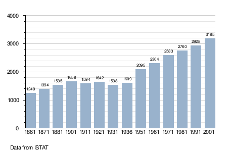
Demographic evolution
References
External links

This article is issued from
Wikipedia.
The text is licensed under Creative Commons - Attribution - Sharealike.
Additional terms may apply for the media files.