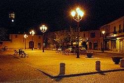
Gerenzano
| Gerenzano | ||
|---|---|---|
| Comune | ||
| Comune di Gerenzano | ||
 | ||
| ||
 Gerenzano Location of Gerenzano in Italy | ||
| Coordinates: 45°38′N 9°0′E / 45.633°N 9.000°E | ||
| Country | Italy | |
| Region | Lombardy | |
| Province | Varese (VA) | |
| Government | ||
| • Mayor | Ivano Campi | |
| Area | ||
| • Total | 9.8 km2 (3.8 sq mi) | |
| Elevation | 226 m (741 ft) | |
| Population (31 January 2009)[1] | ||
| • Total | 10,098 | |
| • Density | 1,000/km2 (2,700/sq mi) | |
| Demonym(s) | Gerenzanesi | |
| Time zone | UTC+1 (CET) | |
| • Summer (DST) | UTC+2 (CEST) | |
| Postal code | 21040 | |
| Dialing code | 02 | |
| Patron saint | Sts. Peter and Paul | |
| Saint day | April 7 | |
| Website | Official website | |

Gerenzano is a comune (municipality) in the Province of Varese in the Italian region Lombardy, located about 25 kilometres (16 mi) northwest of Milan and about 25 kilometres (16 mi) southeast of Varese.
Gerenzano borders the following municipalities: Cislago, Rescaldina, Rovello Porro, Saronno, Turate, Uboldo.
References

This article is issued from
Wikipedia.
The text is licensed under Creative Commons - Attribution - Sharealike.
Additional terms may apply for the media files.