Tai Tapu
| Tai Tapu | |
|---|---|
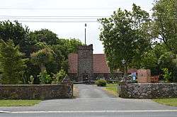 St Paul's church, Tai Tapu | |
 Tai Tapu Location of Tai Tapu | |
| Coordinates: 43°40′12″S 172°33′0″E / 43.67000°S 172.55000°E | |
| Country |
|
| Island | South Island |
| Region | Canterbury |
| Territorial authority | Selwyn District |
| Population (2006 Census)[1] | |
| • Total | 411 |
| Time zone | UTC+12 (NZST) |
| • Summer (DST) | UTC+13 (NZDT) |
| Local iwi | Ngāi Tahu |
Tai Tapu is a large rural area with a small village adjacent to the Halswell River and nestled in the Port Hills, located 6 km east of the town of Lincoln and 18 km south west of Christchurch in the Canterbury region of New Zealand's South Island. State Highway 75 passes through the centre of the village, connecting Christchurch with Akaroa and the Banks Peninsula.
The Tai Tapu Hotel was established in 1856 and is located 1km north of the town centre on a scenic country road. It has a large outdoor dining area that looks over the Halswell River with views to the Tai Tapu Golf Course]
Etymology
The name Tai Tapu is derived from the Māori words wai tapu, which means sacred or solemn water.[2]
The village was previously known as Taitapu, until an official name change in 2009.[3]
The village is often colloquially referred to as 'Tai Tap' by locals.
References
- ↑ Quickstats about Taitapu
- ↑ "Tai Tapu". Victoria University of Wellington. Retrieved 5 January 2012.
- ↑ "Tai Tapu | NZHistory, New Zealand history online". nzhistory.govt.nz. Retrieved 2018-03-15.
External links
![]()