Szabadszállás
| Szabadszállás | ||
|---|---|---|
| Town | ||
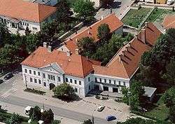 Aerial view | ||
| ||
 Szabadszállás | ||
| Coordinates: 46°52′N 19°13′E / 46.867°N 19.217°E | ||
| Country |
| |
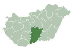
| County | Bács-Kiskun | |
| District | Kunszentmiklós | |
| Area | ||
| • Total | 164.62 km2 (63.56 sq mi) | |
| Population (2015) | ||
| • Total | 6,148 | |
| • Density | 37/km2 (97/sq mi) | |
| Time zone | UTC+1 (CET) | |
| • Summer (DST) | UTC+2 (CEST) | |
| Postal code | 6080 | |
| Area code | (+36) 76 | |
| Website |
www | |

Szabadszállás is a small town in Bács-Kiskun county, Hungary, 80 kilometres south of Budapest by rail. The town is surrounded by several areas of the Kiskunság National Park.
Twin cities
Gallery
External links
| Wikimedia Commons has media related to Szabadszállás. |
- Official website in Hungarian
- Szabadszállás on Google Maps
- (in Hungarian) Szabadszállás a Vendégvárón
- (in Hungarian) Szabadszállás a Gyaloglón
- (in Hungarian) Légifotók Szabadszállásról
| Towns (3) |
| |
|---|---|---|
| Villages (6) | ||

This article is issued from
Wikipedia.
The text is licensed under Creative Commons - Attribution - Sharealike.
Additional terms may apply for the media files.