Bácsbokod
| Bácsbokod Wikitsch (in German) | ||
|---|---|---|
| Large village | ||
| ||
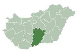
 Bácsbokod Location of Bácsbokod in Hungary | ||
| Coordinates: 46°07′19″N 19°09′32″E / 46.1219°N 19.1589°E | ||
| Country |
| |
| County | Bács-Kiskun | |
| District | Bácsalmás | |
| Area | ||
| • Total | 63.93 km2 (24.68 sq mi) | |
| Population (2015) | ||
| • Total | 2,567 | |
| • Density | 40/km2 (100/sq mi) | |
| Time zone | UTC+1 (CET) | |
| • Summer (DST) | UTC+2 (CEST) | |
| Postal code | 6453 | |
| Area code | (+36) 79 | |

Bácsbokod (Croatian: Bikić, German: Wikitsch) is a large village and municipality in Bács-Kiskun county, in the Southern Great Plain region of southern Hungary. The Danube River (River Duna) flows 20 kilometers to the west of the village.[1]
Geography
It covers an area of 63.93 km2 (25 sq mi) and has a population of about 3101 people.[1]
Demography
Existing ethnicities:
References
- 1 2 "Bácsbokod". National and historical symbols of Hungary (An official site of the Hungarian Government). Retrieved 12 February 2010.
External links
![]()
- Official website in Hungarian
| Town (1) |
| |
|---|---|---|
| Large village (1) | ||
| Villages (8) | ||

This article is issued from
Wikipedia.
The text is licensed under Creative Commons - Attribution - Sharealike.
Additional terms may apply for the media files.