Sulby, Isle of Man
| Sulby | |
|---|---|
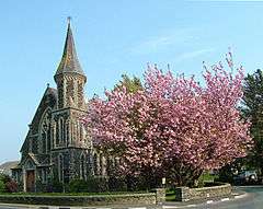 Sulby Methodist Church, a Registered Building | |
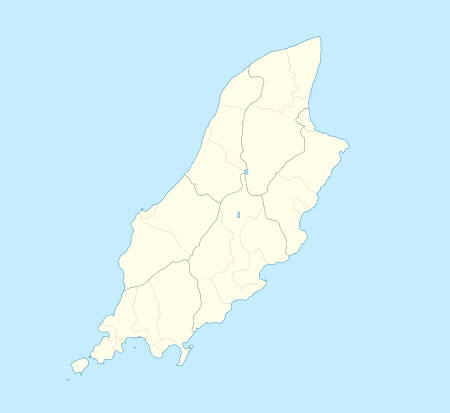 Sulby Sulby shown within the Isle of Man | |
| Population | (2006 Census) |
| OS grid reference | SC380944 |
| Parish | Lezayre |
| Sheading | Ayre |
| Crown dependency | Isle of Man |
| Post town | ISLE OF MAN |
| Postcode district | IM7 |
| Dialling code | 01624 |
| Police | Isle of Man |
| Fire | Isle of Man |
| Ambulance | Isle of Man |
| House of Keys | Ayre |
Sulby, (Old Norse: Sõlabyr ('Soli's estate')),[1] a village in the parish of Lezayre historically containing the Treen of the Curragh of Kirk Christ Lezayre and the Land of the Monks of Myrosco,[2] is located on the Castletown to Ramsey primary A3 road in the Isle of Man, about 7 km west of Ramsey. The name Sulby, Sõlabyr ('Soli's estate')[3] or Sulaby (cleft farm) reflects the Scandinavian influence in Isle of Man place-names. The village is situated at the southern edge of the island's northern alluvial plain, immediately north of the island's northern hills, at the point where the Sulby River emerges from those hills.
The TT racecourse (here the A3) passes along Sulby Straight, where motorcycles attain their highest speeds on the course before braking for the next bend.
The old part of Sulby village is situated along the A14 Tholt-y-Will Road near its junction with the B9 Claddagh Road (grid reference SC382940). This part of Old Sulby Village has a mill and village green. The main part of the village is situated along the main A3 road between Close-e-Volley and Ginger Hall, centred on its junction with the A14, the location of the church, general stores and post office, and an inn. The village has a primary school, a hotel and a large campsite in the river meadow of Sulby Claddagh. The village is dominated by the Sulby River, the Ballamanaugh farm estate, common land of the Claddagh and Cronk Sumark (Cronk = Hill), which includes the remains of an Iron Age fort.
TT races
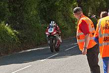
The TT race course passes eastwards along the Sulby Straight (including Sulby Crossroads) before reaching the right-hand bend at Sulby Bridge over the Sulby River, at 19 to 20 miles measured from the startline at the TT Grandstand, before passing Ginger Hall.[5]
During practice for the 2006 TT races, New Zealand competitor Bruce Anstey was timed through a speed trap at 206 mph (332 km/h) on the Sulby Straight,[6] a feat repeated in 2015 by TT competitor James Hillier riding the Kawasaki H2R factory concept bike during a demonstration lap, recorded on Strava datalogging equipment.[7]

The part of the race course including Sulby village on the A3 road, including the one-mile Sulby Straight,[8] was part of Four Inch Course used for the Tourist Trophy car races between 1905 and 1911, and the Mountain Course used since 1911 for the Isle of Man TT and Manx Grand Prix races.
Produce
ManX Spirit is a clear alcoholic beverage which is distilled from whisky by Kella Distillers Ltd in Sulby.
See also
Sources
- ↑ Place Names of the Isle of Man by John Kneen MA page 545 (1970) Yn Çheshaght Ghailckagh The Scolar Press
- ↑ Place Names of the Isle of Man by John Kneen MA page 545 (1970) Yn Çheshaght Ghailckagh The Scolar Press
- ↑ c. 1376 Chron. Mann. Sulaby, 1515 Man. Roll Soulby, 1703 Sulby Scand. Sõlabyr, 'Soli's estate.' Manx notebook
- ↑ Supersport TT Race 1 Results IoM TT.com, Retrieved 14 November 2015
- ↑ The Lucas contour map of the T.T. circuit, 1973. Accessed 23 December 2015
- ↑ "Archived copy". Archived from the original on 2 January 2008. Retrieved 9 June 2013. New Isle of Man Top Speed Record (retrieved 12 August 2006)
- ↑ Hillier hits highest speed on H2R IoM TT.com Official site Retrieved 20 June 2015
- ↑ 54°19′08″N 4°29′24″W / 54.319°N 4.490°W
| Wikimedia Commons has media related to Sulby, Isle of Man. |