Andreas (parish)
Coordinates: 54°22′01″N 4°26′42″W / 54.367°N 4.445°W
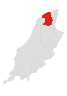
Andreas is a parish in the sheading of Ayre in the north of the Isle of Man. The other two parishes in Ayre are Bride and Lezayre.[1] Andreas borders Jurby to the west, Bride to the east and Lezayre to the south. The Irish Sea is to the north.
Geography
The parish is low-lying. The most significant inland water feature is the Lhen Trench, which runs for about 7 km north-south, in parallel with the boundary with Jurby. To the north the Scottish Southern Uplands and the Mull of Galloway can sometimes clearly be seen. The total area is about 15 square miles (39 km2).
The village of Andreas or Kirk Andreas is the only significant settlement in the parish. The nearest town, Ramsey, is 4 miles or 6 km away.
Politically it is part of the Ayre & Michael constituency, which elects two MHKs.
Demographics
The Isle of Man census of 2016 returned a parish population of 1,397, a decrease of 2.1% from the figure of 1,426 in 2011.[2]
Andreas Airfield
Near the middle of the parish is the former RAF Andreas airfield. It is home to a small number of privately owned light aircraft and also used by a gliding club.
References
External links
- Manxnotebook Andreas Detail about Manx parishes and description of the parish.
- Manxnotebook - Andreas with full description of the parish and photographs
- Manxnotebook Kirk Andreas Antiquities
- Isle of Man Building Control Districts showing parish boundaries
- Glenology - Manx Glens An ongoing study of Manx glens, their locations and meanings.
| Towns |
| ||||||||
|---|---|---|---|---|---|---|---|---|---|
| Villages | |||||||||
| Sheadings | |||||||||
| Parishes | |||||||||
| Transport | |||||||||
| Heraldry | |||||||||
| Education |
| ||||||||