Strzelecki Regional Reserve
| Strzelecki Regional Reserve South Australia | |
|---|---|
|
IUCN category VI (protected area with sustainable use of natural resources) | |
 Strzelecki Regional Reserve | |
| Nearest town or city | Marree |
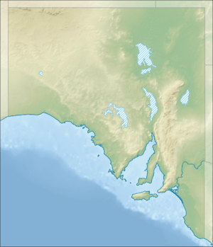
| Coordinates | 28°53′01″S 139°48′10″E / 28.88361°S 139.80278°ECoordinates: 28°53′01″S 139°48′10″E / 28.88361°S 139.80278°E |
| Established | 19 December 1991[1] |
| Area | 8,104.26 km2 (3,129.1 sq mi)[1] |
| Managing authorities | Department of Environment, Water and Natural Resources |
| Footnotes | Coordinates[2] |
| See also | Protected areas of South Australia |
Strzelecki Regional Reserve is a protected area located in the Australian state of South Australia in the gazetted localities of Lindon and Strzelecki Desert about 493 kilometres (306 miles) north-east of Port Augusta.[3][4] It includes the Strzelecki Desert and the dry Strzelecki Creek bed. The regional reserve can only accessed via the historic Strzelecki Track. It is partly located on land that was included on the List of Wetlands of International Importance under the Ramsar Convention under the name Coongie Lakes in 1987.[5] The regional reserve is classified as an IUCN Category VI protected area.[2]
See also
References
- 1 2 "Protected Areas Information System - reserve list (as of 25 November 2014)" (PDF). Department of Environment Water and Natural Resources. Retrieved 8 January 2015.
- 1 2 "Terrestrial Protected Areas of South Australia (see 'DETAIL' tab)". CAPAD 2014. Australian Government - Department of the Environment. 2014. Retrieved 13 March 2015.
- ↑ "Search result for "Lindon (LOCB)" (Record no SA0067097) with the following layers selected - "Suburbs and Localities" and "Place names (gazetteer)"". Property Location Browser. Government of South Australia. Retrieved 21 September 2016.
- ↑ "Search result for "Strzelecki Desert (LOCB)" (Record no SA0067187) with the following layers selected - "Suburbs and Localities", "Place names (gazetteer)" and "Road Labels"". Property Location Browser. Government of South Australia. Retrieved 21 September 2016.
- ↑ "Coongie Lakes Ramsar wetlands; a plan for wise use" (PDF). Department of Environment, Heritage & Aboriginal Affairs. 1999. p. 2. Retrieved 15 January 2015.
External links
This article is issued from
Wikipedia.
The text is licensed under Creative Commons - Attribution - Sharealike.
Additional terms may apply for the media files.