Mullinger Swamp Conservation Park
| Mullinger Swamp Conservation Park South Australia | |
|---|---|
|
IUCN category IV (habitat/species management area) | |
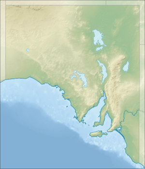 Mullinger Swamp Conservation Park | |
| Nearest town or city | Kybybolite. |
| Coordinates | 36°51′13″S 140°58′07″E / 36.8535°S 140.9686°ECoordinates: 36°51′13″S 140°58′07″E / 36.8535°S 140.9686°E |
| Established | 15 January 1976[1] |
| Area | 13 hectares (32 acres)[2] |
| Visitation | not stated (refer below) (in 1992)[3] |
| Managing authorities | Department of Environment, Water and Natural Resources |
| Footnotes |
Coordinates[4] Nearest town[5] Managing authority[2] |
| See also | Protected areas of South Australia |
Mullinger Swamp Conservation Park is a protected area in the Australian state of South Australia located in the state’s Limestone Coast in the gazetted locality of Kybybolite on the border with the state of Victoria about 25 kilometres (16 mi) north-east of Naracoorte.[5]
The conservation park occupies land in section 681 of the cadastral unit of the Hundred of Binnum which was proclaimed on 15 January 1976 under the National Parks and Wildlife Act 1972. Prior to proclamation, the land was “vacant Crown Land” which may have been used for grazing.[3][1] As of July 2016, the conservation park covered an area of 13 hectares (32 acres).[2]
The conservation park occupies about 35% of the extent of the Mullinger Swamp with the remainder being located in Victoria and which received protected area status as the Mullinger Swamp Wildlife Reserve in 1983. [3][6]
In 1992, the conservation park was described as having soils that were “alkaline, poorly drained, deep, grey, self-mulching, cracking clay” while the land surrounding the swamp had “alkaline. imperfectly drained, hard, apedal. mottled-yellow, duplex soils.” The latter supported “a river red gum open forest with a disturbed understorey of wallaby grass (Danthonia sp.), introduced grasses and pasture weeds such as Cape weed (Arctotheca calendula).”
As of 1992, the conservation park was used by “local and district residents” for “picnics, fishing and swimming” and “on occasions by field naturalists and birdwatchers.” However, its attraction as a swimming site has declined due to the establishment of a swimming lake in Naracoorte.[3]
The conservation park is classified as an IUCN Category IV protected area.[4]
See also
References
- 1 2 "NATIONAL PARKS AND WILDLIFE ACT, 1972-1974: HUNDRED OF BINNUM—MULLINGER SWAMP CONSERVATION PART CONSTITUTED" (PDF). The South Australian Government Gazette. Government of South Australia: 173. 15 January 1976. Retrieved 14 January 2017.
- 1 2 3 "Protected Areas Information System - reserve list (as of 11 July 2016)" (PDF). Department of Environment Water and Natural Resources. 11 July 2016. Retrieved 14 July 2016.
- 1 2 3 4 South Australia. National Parks and Wildlife Service. South East District; Sutherland, Andrea; South Australia. National Parks and Wildlife Service (1992), Small parks of the upper South East management plans, South East, South Australia (PDF), Dept. of Environment and Planning, pp. 24–26, ISBN 978-0-7308-2665-1
- 1 2 "Terrestrial Protected Areas of South Australia (see 'DETAIL' tab)". CAPAD 2014. Australian Government, Department of the Environment (DoE). 2014. Retrieved 20 June 2016.
- 1 2 "Search result(s) for Mullinger Swamp Conservation Park (Record No. SA0047605) with the following layers being selected - "Parcel labels", "Suburbs and Localities", "Hundreds", "Place names (gazetteer)" and "Road labels"". Property Location Browser. Government of South Australia. Retrieved 14 January 2017.
- ↑ "Terrestrial Protected Areas of Victoria (see 'DETAIL' tab)". CAPAD 2014. Australian Government, Department of the Environment (DoE). 2014. Retrieved 13 January 2017.