Calpatanna Waterhole Conservation Park
| Calpatanna Waterhole Conservation Park South Australia | |
|---|---|
|
IUCN category Ia (strict nature reserve) | |
 Calpatanna Waterhole Conservation Park | |
| Nearest town or city | Streaky Bay. |
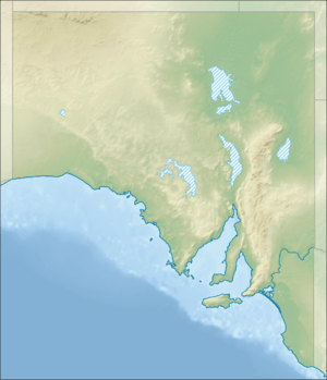
| Coordinates | 32°59′39″S 134°20′32″E / 32.9943°S 134.3423°ECoordinates: 32°59′39″S 134°20′32″E / 32.9943°S 134.3423°E |
| Established | 14 February 1974[1] |
| Area | 36.44 km2 (14.1 sq mi)[1] |
| Managing authorities | Department of Environment, Water and Natural Resources |
| Website | Calpatanna Waterhole Conservation Park |
| Footnotes |
Coordinates[2] Nearest town[3] Managing authority[1] |
| See also | Protected areas of South Australia |
Calpatanna Waterhole Conservation Park is a protected area in the Australian state of South Australia located on the Eyre Peninsula in the gazetted localities of Calca, Mortana and Yanerbie about 25 kilometres (16 mi) south-east of the town centre in Streaky Bay.[3]
The conservation park was proclaimed on 14 February 1974 under the state’s National Parks and Wildlife Act 1972 in respect to land in sections 121, 122, 128, 129, 144, 179, 180 and 189 in the cadastral unit of the Hundred of Wrenfordsley. Land in sections 248 and 249 was added on 16 July 1985.[4][5] Its name is derived from the Calpatanna Waterhole which is located within its boundaries. [3] As of July 2016, the conservation park covered an area of 36.44 square kilometres (14.07 sq mi).[1]
As of 2017, the conservation park’s habitat was described by the South Australian Ornithological Association as follows: [6]
There is a 500 hectare claypan lagoon in the south-western quadrant of Calpatanna Waterhole Conservation Park and a complex of smaller lakes along the remainder of the western side. In this area a narrow zone of samphire low shrubland is found. A complex system of low-lying but rarely inundated flats extends from the western salt lakes to the eastern boundary covering approximately 26 per cent of the park’s area (sic). These flats support an open-scrub dominated by Swamp Paper-bark (Melaleuca halmaturorum). Much of the park (sic) is dominated by mallee open-scrub with White Mallee (Eucalyptus dumosa), Yorrell (E. gracilis), Kingscote Mallee (E. rugosa) and Yalata Mallee (E. yalatensis). There are also areas of introduced grassland as a result from clearing and grazing of native vegetation before the dedication of the park (sic).
The conservation park is classified as an IUCN Category IA protected area.[2]
See also
References
- 1 2 3 4 "Protected Areas Information System - reserve list (as of 11 July 2016)" (PDF). Department of Environment Water and Natural Resources. 11 July 2016. Retrieved 14 July 2016.
- 1 2 "Terrestrial Protected Areas of South Australia (see 'DETAIL' tab)". CAPAD 2014. Australian Government, Department of the Environment (DoE). 2014. Retrieved 20 June 2016.
- 1 2 3 "Search result(s) for Calpatanna Waterhole Conservation Park (Record No. SA0044649) with the following layers being selected - "Parcel labels", "Suburbs and Localities", "Hundreds", "Place names (gazetteer)" and "Road labels"". Property Location Browser. Government of South Australia. Archived from the original on 12 October 2016. Retrieved 4 January 2017.
- ↑ "NATIONAL PARKS AND WILDLIFE ACT, 1972: HUNDRED OF WRENFORDSLEY—CALPATANNA WATERHOLE CONSERVATION PARK CONSTITUTED" (PDF). The South Australian Government Gazette. Government of South Australia: 475. 14 February 1974. Retrieved 5 January 2017.
- ↑ "NATIONAL PARKS AND WILDLIFE ACT, 1972: SECTIONS 248 AND 249: HUNDRED OF WRENFORDSLEY: ALTERATION OF BOUNDARIES OF CALPATANNA WATERHOLE CONSERVATION PARK" (PDF). The South Australian Government Gazette. Government of South Australia: 92. 11 July 1985. Retrieved 5 January 2017.
- ↑ "Calpatanna Waterhole Conservation Park". South Australian Ornithological Association Incorporated trading as Birds SA. 5 January 2017. Retrieved 5 January 2017.