Mamungari Conservation Park
| Mamungari Conservation Park South Australia | |
|---|---|
|
IUCN category Ia (strict nature reserve) | |
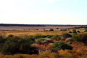 Serpentine Lakes | |
 Mamungari Conservation Park | |
| Nearest town or city | Eucla |
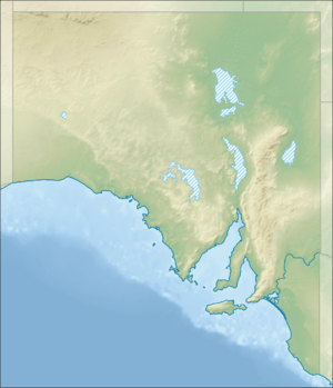
| Coordinates | 29°8′26″S 129°15′8″E / 29.14056°S 129.25222°ECoordinates: 29°8′26″S 129°15′8″E / 29.14056°S 129.25222°E |
| Established | 7 May 1970[1] |
| Area | 21,289.45 km2 (8,219.9 sq mi)[2] |
| Managing authorities |
DEWNR Maralinga Tjarutja Community |
| Website | Mamungari Conservation Park |
| See also | Protected areas of South Australia |
Mamungari Conservation Park (formerly known as Unnamed National Park, Unnamed Conservation Park and also known as the Unnamed Biosphere Reserve) is a protected area located in South Australia within the southern Great Victoria Desert and northern Nullarbor Plain about 200 kilometres (120 miles) west of Maralinga and 450 kilometres (280 miles) northwest of Ceduna.
The conservation park was proclaimed in 1970 as a national park under the then National Parks Act 1966 for the purpose of conserving ‘the environments of the Great Victoria Desert and protect wilderness values.’ It was not assigned a name in 1970 and was subsequently constituted as the Unnamed Conservation Park under the National Parks and Wildlife Act 1972. It was renamed as Mamungari Conservation Park on 30 November 2006.[3]
It is one of fourteen United Nations Educational, Scientific and Cultural Organization (UNESCO) World Biosphere Reserves in Australia and obtained this status in 1977 with the name of the Unnamed Biosphere Reserve.[4][5]
The conservation park is classified as an IUCN Category Ia protected area.[6]
The conservation park is managed jointly by the traditional owners (the Maralinga Tjarutja and the Pila Nguru communities) and the Department of Environment, Water and Natural Resources (DEWNR).[3]
The conservation park may only be visited by those who have obtained the minimum impact code and can demonstrate experience using that code. Permits are required to travel to the conservation park and will take 4 to 6 weeks to arrange. The only road of significance that passes through the conservation park is the Anne Beadell Highway.
See also
References
- ↑ Degaris, R.C. (7 May 1970). "NATIONAL PARKS ACT, 1966: DECLARATION OF NATIONAL PARK" (PDF). The South Australian Government Gazette. South Australian Government. p. 1648. Retrieved 28 March 2018.
- ↑ "Protected Areas Information System - reserve list (as of 17 Feb 2014)" (PDF). Department of Environment Water and Natural Resources. Retrieved 26 March 2014.
- 1 2 "Mamungari Conservation Park Management Plan" (PDF). Mamungari Conservation Park Board of Management. 2011. p. 1. Retrieved 3 November 2014.
- ↑ "Australia's Biosphere Reserves". Parks Australia. Retrieved 3 November 2014.
- ↑ "Biosphere Reserve Information for ' UNNAMED'". UNESCO. Retrieved 3 November 2014.
- ↑ "CAPAD 2012 South Australia Summary (see 'DETAIL' tab)". CAPAD 2012. Australian Government - Department of the Environment. 6 February 2014. Retrieved 6 February 2014.
External links
- Mamungari Conservation Park official webpage
- Mamungari Conservation Park webpage on protected planet
- Webpage for the Unnamed Biosphere Reserve on the UNESCO website
- http://www.communitywebs.org/fgvd/ The Friends of the Great Victoria Desert Parks webpage]