Strayhorse, Arizona
| Strayhorse, Arizona | |
|---|---|
| Populated place | |
 Strayhorse Location within the state of Arizona  Strayhorse Strayhorse (the US) | |
| Coordinates: 33°33′02″N 109°19′05″W / 33.55056°N 109.31806°WCoordinates: 33°33′02″N 109°19′05″W / 33.55056°N 109.31806°W | |
| Country | United States |
| State | Arizona |
| County | Greenlee |
| Elevation[1] | 7,782 ft (2,372 m) |
| Time zone | UTC-7 (Mountain (MST)) |
| • Summer (DST) | UTC-7 (MST) |
| Area code(s) | 928 |
| FIPS code | 04-70065 |
| GNIS feature ID | 34896 |
Strayhorse is a populated place situated in Greenlee County, Arizona.[2] It has an estimated elevation of 7,782 feet (2,372 m) above sea level.[1] The name was derived from a stray horse which lived in the area, and local ranchers began to call the area by that name.[3]
References
- 1 2 "Feature Detail Report for: Strayhorse". Geographic Names Information System. United States Geological Survey.
- ↑ "Strayhorse (in Greenlee County, AZ) Populated Place Profile". AZ Hometown Locator. Retrieved April 28, 2017.
- ↑ Barnes, Will Croft (2016). Arizona Place Names. Tucson: University of Arizona Press. p. 427. ISBN 0816534950.
Municipalities and communities of Greenlee County, Arizona, United States | ||
|---|---|---|
| Towns | 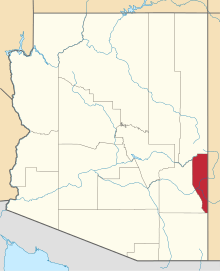 | |
| CDPs | ||
| Populated places | ||
This article is issued from
Wikipedia.
The text is licensed under Creative Commons - Attribution - Sharealike.
Additional terms may apply for the media files.