Franklin, Arizona
| Franklin, Arizona | |
|---|---|
| Census-designated place | |
 Location of Franklin in Greenlee County, Arizona. | |
 Franklin Location of Franklin in Greenlee County, Arizona.  Franklin Franklin (the US) | |
| Coordinates: 32°40′37″N 109°4′20″W / 32.67694°N 109.07222°WCoordinates: 32°40′37″N 109°4′20″W / 32.67694°N 109.07222°W | |
| Country | United States |
| State | Arizona |
| County | Greenlee |
| Area[1] | |
| • Total | 1.00 sq mi (2.59 km2) |
| • Land | 1.00 sq mi (2.59 km2) |
| • Water | 0.00 sq mi (0.00 km2) |
| Elevation | 3,730 ft (1,140 m) |
| Population (2010) | |
| • Total | 22,489 |
| • Estimate (2016)[2] | N/A |
| Time zone | UTC-7 (MST (no DST)) |
| ZIP code | 85534 |
| Area code(s) | 928 |
| FIPS code | 04-25650 |
| GNIS feature ID | 2582787 |
| Website | 04-25650 |
Franklin is an unincorporated community and census-designated place in Greenlee County, Arizona, United States. As of the 2010 census it had a population of 92.[3] It is located in southern Greenlee County along U.S. Route 70, 3 miles (5 km) south of Duncan and 32 miles (51 km) south of Clifton. Residents of Franklin are zoned to use Duncan public schools, like the nearby communities of York, Arizona, and Virden, New Mexico. A large share of the residents work for the Morenci Mine, owned by Freeport-McMoRan in Morenci, Arizona.
Demographics
| Historical population | |||
|---|---|---|---|
| Census | Pop. | %± | |
| U.S. Decennial Census[4] | |||
References
- ↑ "2016 U.S. Gazetteer Files". United States Census Bureau. Retrieved Jul 18, 2017.
- ↑ "Population and Housing Unit Estimates". Retrieved June 9, 2017.
- ↑ "Geographic Identifiers: 2010 Demographic Profile Data (G001): Franklin CDP, Arizona". U.S. Census Bureau, American Factfinder. Retrieved November 10, 2016.
- ↑ "Census of Population and Housing". Census.gov. Retrieved June 4, 2016.
Municipalities and communities of Greenlee County, Arizona, United States | ||
|---|---|---|
| Towns | 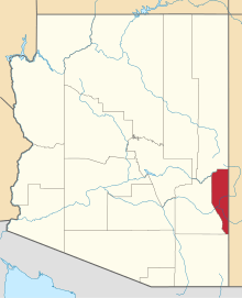 | |
| CDPs | ||
| Populated places | ||
This article is issued from
Wikipedia.
The text is licensed under Creative Commons - Attribution - Sharealike.
Additional terms may apply for the media files.