Sheldon, Arizona
| Sheldon, Arizona | |
|---|---|
| Populated place | |
 Sheldon Location within the state of Arizona  Sheldon Sheldon (the US) | |
| Coordinates: 32°48′53″N 109°10′20″W / 32.81472°N 109.17222°WCoordinates: 32°48′53″N 109°10′20″W / 32.81472°N 109.17222°W | |
| Country | United States |
| State | Arizona |
| County | Greenlee |
| Elevation[1] | 3,586 ft (1,093 m) |
| Time zone | UTC-7 (Mountain (MST)) |
| • Summer (DST) | UTC-7 (MST) |
| Area code(s) | 928 |
| FIPS code | 04-65910 |
| GNIS feature ID | 24612 |
Sheldon is a populated place situated in Greenlee County, Arizona, near the border with New Mexico.[2] It is named after Lionel Sheldon, who served as governor of the New Mexico Territory from 1881 to 1885. A post office was opened at this location in 1908, and remained in operation until its closure in 1919. It has an estimated elevation of 3,586 feet (1,093 m) above sea level.[1]
References
- 1 2 "Feature Detail Report for: Sheldon". Geographic Names Information System. United States Geological Survey.
- ↑ "Sheldon (in Greenlee County, AZ) Populated Place Profile". AZ Hometown Locator. Retrieved March 22, 2017.
Municipalities and communities of Greenlee County, Arizona, United States | ||
|---|---|---|
| Towns | 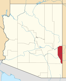 | |
| CDPs | ||
| Populated places | ||
This article is issued from
Wikipedia.
The text is licensed under Creative Commons - Attribution - Sharealike.
Additional terms may apply for the media files.