Sotará (volcano)
| Sotará | |
|---|---|
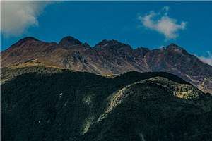 Sotará in 2016 | |
| Highest point | |
| Elevation | 4,580 m (15,030 ft) |
| Listing | Volcanoes of Colombia |
| Coordinates | 2°06′29″N 76°35′31″W / 2.108°N 76.592°WCoordinates: 2°06′29″N 76°35′31″W / 2.108°N 76.592°W |
| Geography | |
 Sotará Location of Sotará in Colombia | |
| Location |
Cauca |
| Parent range | Central Ranges, Andes |
| Geology | |
| Mountain type | Extinct basaltic-andesitic stratovolcano |
| Volcanic belt |
North Volcanic Zone Andean Volcanic Belt |
| Last eruption | unknown |
Sotará is a stratovolcano located in Cauca, Colombia. The volcano has hot springs of 80 °C (176 °F) and fumarole activity with a composition of 80% CO2 and 20% H2S.[1] The volcano is located between the Silvia-Pijao Fault in the west and the San Jerónimo Fault in the east.[2]
Gallery
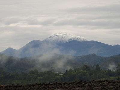 Sotará in 2010
See also
References
Bibliography
- Orrego, Abigail; Luis León; Luis Eduardo Padilla; Álvaro Pablo Acevedo, and Nelson Marulanda. 1999. Plancha 364 - Timbío - 1:100,000, 1. INGEOMINAS. Accessed 2017-06-06.
- N., N. s.a. Volcán Sotará, 1. INGEOMINAS. Accessed 2017-06-09.
External links
| Wikimedia Commons has media related to Sotará (volcano). |
| Western Ranges | | |
|---|---|---|
| Central Ranges |
| |
| Eastern Ranges |
| |
| Other | ||
| Source |
| |
This article is issued from
Wikipedia.
The text is licensed under Creative Commons - Attribution - Sharealike.
Additional terms may apply for the media files.