Solar eclipse of October 7, 2135
| Solar eclipse of October 7, 2135 | |
|---|---|
 Map | |
| Type of eclipse | |
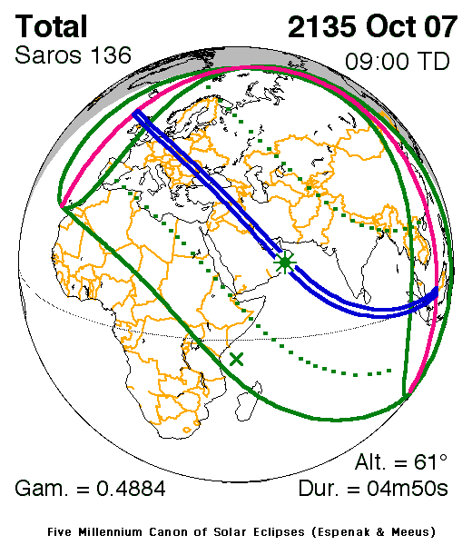
| Nature | Total |
| Gamma | 0.4884 |
| Magnitude | 1.0603 |
| Maximum eclipse | |
| Duration | 290 sec (4 m 50 s) |
| Coordinates | 20°18′N 57°36′E / 20.3°N 57.6°E |
| Max. width of band | 224 km (139 mi) |
| Times (UTC) | |
| Greatest eclipse | 9:00:03 |
| References | |
| Saros | 136 (44 of 71) |
| Catalog # (SE5000) | 9814 |
The total solar eclipse of October 7, 2135 will successively be seen in the following 23 countries: [1]
Length
Maximum
The point of maximum totality is located in Oman between the cities of Al Khaluf and Duqm and lasts 4m49,4s.
Limitations
| Phenomenon | Code | Time UTC [2] |
|---|---|---|
| First penumbral contact | P1 | 06:31:21.6 |
| First umbral contact | U1 | 07:24:24.7 |
| Maximum eclipse | GE | 08:55:12.5 |
| Last umbral contact | U4 | 10:26:01.3 |
| Last penumbral contact | P4 | 11:18:46.7 |
References
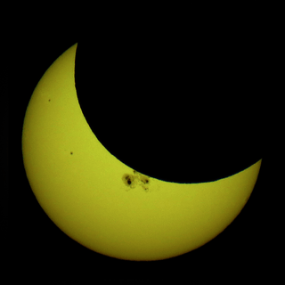
- ↑ Still image of this event, by NASA
- ↑ Times are approximate, because taken from Google Maps page.
External links


This article is issued from
Wikipedia.
The text is licensed under Creative Commons - Attribution - Sharealike.
Additional terms may apply for the media files.